Near Louisbourg in Cape Breton Region, Nova Scotia — The Atlantic Provinces (North America)
Marie Marguerite Rose
(1717-1757)
Photographed by Barry Swackhamer, July 3, 2014
1. Marie Marguerite Rose Marker

English:
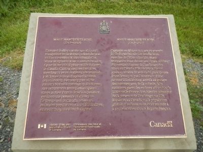
Captured in Africa at the age of 19 and transported to Ile Royale, where she was sold to a member of the colonial elite, Marie Marguerite Rose is seen to be a key figure of the initial phase of Black slavery in Canada. Gaining her freedom after spending 19 years in slavery, she married a Mi'kmaw man and opened a tavern in Louisbourg, becoming part of the colony's business community. Both were rare occurrences among emancipated slaves in New France. Rose's experience speaks to the presence of slavery on Ile Royale and in Canada, where an estimated population of 1,375 Black slaves existed during the French Regime.
French
this page online
Erected by Historic Sites and Monument Board of Canada/Commission de lieux et monuments historique du Canada.
Topics and series. This historical marker is listed in these topic lists: African Americans • Women. In addition, it is included in the Acadian History, and the Canada, Historic Sites and Monuments Board series lists.
Location. 45° 53.519′ N, 59° 59.058′ W. Marker is near Louisbourg, Nova Scotia, in Cape Breton Region. It is on Royale. Touch for map. Marker is in this post office area: Louisbourg NS B1C 2L2, Canada. Touch for directions.

Regionally, this marker is on Nova Scotia’s Cape Breton Island. It is also in the Maritimes and in Atlantic Canada. Globally, it is in the North Atlantic Region, North America, the Western Hemisphere, the Western World, and the Anglosphere. Historically, it finds itself in what was once a British colony, the Viceroyalty of New France, and Acadia.
Other nearby markers. At
Photographed by Barry Swackhamer, July 3, 2014
2. Marie Marguerite Rose Marker
This marker is in the center/
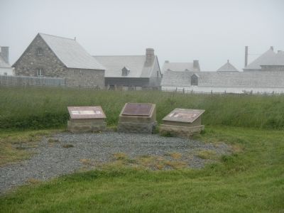
More about this marker. This marker in on the grounds of Fortress Louisbourg near the McLennan House.
Credits. This page was last revised on March 16, 2025. It was originally submitted on December 27, 2014, by Barry Swackhamer of Brentwood, California. This page has been viewed 1,116 times since then and 94 times this year. Photos: 1, 2. submitted on December 27, 2014, by Barry Swackhamer of Brentwood, California. • Andrew Ruppenstein was the editor who published this page.
