Auburn in Lee County, Alabama — The American South (East South Central)
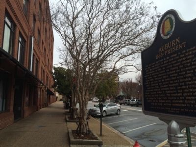
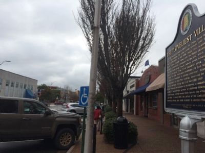
Auburn 1865~Present / The "Loveliest Village"
Side 1
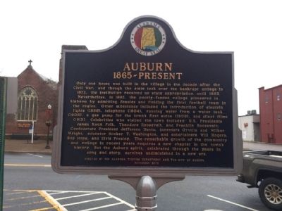
1865~Present
Only one house was built in the village in the decade after the Civil War, and though the state took over the bankrupt college in 1872, the institution received no state appropriation until 1883. Nevertheless, in 1892, the poorly-funded college pioneered in Alabama by admitting females and fielding the first football team in the region. Other milestones included the introduction of electric lights (1886), telephone (1904), running water from a water tank (1908), a gas pump for the town’s first autos (1909), and silent films (1913). Celebrities who visited the town included: U.S. Presidents James Knox Polk, Theodore Roosevelt, and Franklin Roosevelt; Confederate President Jefferson Davis; inventors Orville and Wilbur Wright, educator Booker T. Washington, and entertainers Will Rogers, Bob Hope, and Elvis Presley. The remarkable growth of the community and college in recent years requires a new chapter in the town’s history. But the Auburn spirit, celebrated through the years in song and story, survives undiminished in a new era.
Side 2
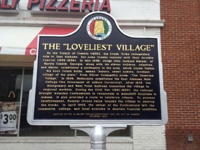
By the Treaty of Cusseta (1832), the Creek Tribe relinquished title to East Alabama, but some Creeks resisted until their forcible removal (1832-1836). In late 1836, Judge John Jackson Harper, of Harris County, Georgia, along with his eleven children, relatives, and slaves, established a settlement in the area, which Lizzie Taylor, his son’s future bride, named “Auburn, sweet Auburn, loveliest village of the plain,” from Oliver Goldsmith’s poem, “The Deserted Village.” In 1856, Methodists established the East Alabama Male College (the forerunner of Auburn University). After 1847, the Montgomery and West Point Railroad connected the village to regional markets. During the Civil War (1861-1865), the railroad brought wounded Confederates to recuperate in makeshift hospitals in Auburn. It also provided a route to reinforce Atlanta. To prevent reinforcement, Federal troops twice invaded the village to destroy the tracks. In April 1865, the defeat of the Confederacy left the community, college, and local economy in desolate financial condition.
Erected 2010 by the Alabama Tourism Department and the City of Auburn.
Topics and series. This historical marker is listed in these topic lists: Education • Settlements & Settlers • War, US Civil. In addition, it is included in the Former U.S. Presidents: #11 James K. Polk, the Former U.S. Presidents: #26 Theodore Roosevelt, and the Former U.S. Presidents: #32 Franklin D. Roosevelt series lists. A significant historical month for this entry is April 1865.
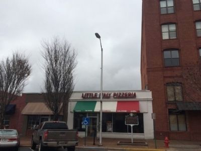
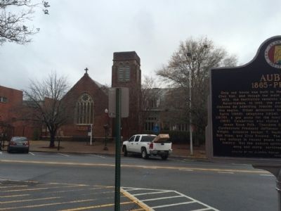
Location. 32° 36.4′ N, 85° 28.854′ W. Marker is in Auburn, Alabama, in Lee County. Marker is on East Magnolia Avenue, 0.1 miles east of North College Street (Alabama Route 15), on the right when traveling west. Touch for map. Marker is at or near this postal address: 129 East Magnolia Avenue, Auburn AL 36830, United States of America. Touch for directions.
Other nearby markers. At least 8 other markers are within walking distance of this marker. Auburn - Alabama (about 300 feet away, measured in a direct line); Auburn United Methodist Church Founder's Chapel (about 400 feet away); City Hall (about 600 feet away); Auburn University Chapel (approx. 0.2 miles away); The Lathe (approx. 0.2 miles away); The East Alabama Methodist College (approx. 0.2 miles away); Auburn First Baptist Church (approx. 0.2 miles away); Luckie Meagher's Kindergarten / Sani-Freeze Dairy Bar (approx. 0.2 miles away). Touch for a list and map of all markers in Auburn.
Also see . . . History of Auburn. Encyclopedia of Auburn entry (Submitted on December 28, 2014, by Mark Hilton of Montgomery, Alabama.)
Credits. This page was last revised on August 29, 2020. It was originally submitted on December 28, 2014, by Mark Hilton of Montgomery, Alabama. This page has been viewed 1,127 times since then and 82 times this year. Photos: 1, 2, 3, 4, 5, 6. submitted on December 28, 2014, by Mark Hilton of Montgomery, Alabama.
