Corning in Steuben County, New York — The American Northeast (Mid-Atlantic)
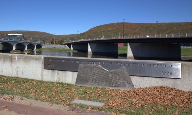
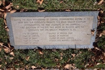
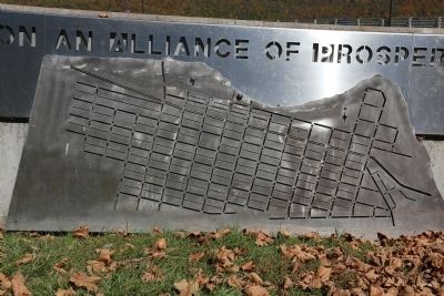
At This Location an Alliance of Prosperity was Formed
1868–2001
City of Corning • Town of Corning • Town of Erwin • Town of Lindley • Town of Caton • Village of Painted Post • Village of Riverside • Village of South Corning • Citizens and Business Community
Topics. This historical marker is listed in these topic lists: Industry & Commerce • Notable Events. A significant historical year for this entry is 2001.
Location. 42° 8.671′ N, 77° 3.185′ W. Marker is in Corning, New York, in Steuben County. Marker can be reached from East Tioga Avenue near Cedar Street / Centerway (New York State Route 414). It is in Centennial Park on the river wall that runs between the Centerway Pedestrian Bridge and the new bridge. Touch for map. Marker is in this post office area: Corning NY 14830, United States of America. Touch for directions.
Other nearby markers. At least 8 other markers are within walking distance of this marker. Centerway Bridge (about 300 feet away, measured in a direct line); Galvin and Haines Insurance (about 500 feet away); Ecker Drug Store (about 500 feet away); Market Street Historic District (about 500 feet away); Concert Hall Block (about 600 feet away); Brown's Cigar Store (about 600 feet away); The Rockwell Museum (about 700 feet away); City of Corning (about 700 feet away). Touch for a list and map of all markers in Corning.
Regarding At This Location an Alliance of Prosperity was Formed. When the Brooklyn Flint Glass Works moved to Corning, N.Y. in 1868, canal boats took the long journey from Brooklyn, hauling furnaces, pots, blowpipes, molds, and more. The boats were towed up the Hudson River to Albany and poled west to the Seneca Canal via the Erie Canal. The boats then headed south toward Geneva and entered Seneca Lake, leading them to Watkins Glen. From Watkins Glen, boats floated into the Chemung Canal southbound to Horseheads. At this point, the boats met with the Fedeer Canal to Gibson. They finished their journey by poling upstream to Corning, and docking at Pine Street.
Also see . . . Corning - America's Most Fun Small Town. Steuben County CVB Website entry (Submitted on December 23, 2021, by Larry Gertner of New York, New York.)
Credits. This page was last revised on December 23, 2021. It was originally submitted on January 1, 2015, by J. J. Prats of Powell, Ohio. This page has been viewed 492 times since then and 40 times this year. Photos: 1, 2, 3. submitted on January 1, 2015, by J. J. Prats of Powell, Ohio.


