Pensacola Beach in Escambia County, Florida — The American South (South Atlantic)
First Religious Service in Pensacola
Photographed by Mark Hilton, December 31, 2014
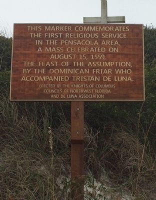
1. First Religious Service in Pensacola Marker
the first religious service
in the Pensacola area,
a mass celebrated on
August 15, 1559,
The Feast of the Assumption,
by the Dominican Friar who
accompanied Tristan de Luna.
Erected by the Knights of Columbus Councils of Northwest Florida and de Luna Association.
Topics. This historical marker is listed in these topic lists: Exploration • Religion & Religious Structures • Settlements & Settlers. A significant historical year for this entry is 1559.
Location. 30° 19.722′ N, 87° 9.492′ W. Marker is in Pensacola Beach, Florida, in Escambia County. It is on Fort Pickens Road 1.2 miles west of Via de Luna Drive (State Road 399), on the left when traveling west. Touch for map. Marker is at or near this postal address: Fort Pickens Road, Gulf Breeze FL 32561, United States of America. Touch for directions.

Regionally, this marker is in Greater Pensacola and on the Florida Panhandle. It is also in the American South, specifically in the Deep South, and on the Gulf Coast. Globally, it is in the North Atlantic Region, North America, a Gulf of Mexico state, the Western Hemisphere,
this page online
Other nearby markers. At least 8 other markers are within 7 miles of this marker, measured as the crow flies: Site of Pensacola - St. Augustine Road (approx. 2.7 miles away); First Federal Tree Farm (approx. 2.9 miles away); Live Oaks and Naval Ship Timbers (approx. 3 miles away); USCGC Sebago (WPG/WHEC 42) (approx. 6 miles away); Middle Passage to Pensacola / African Presence in Colonial Pensacola (approx. 6.1 miles away); Luna Expedition (approx. 6.1 miles away); Spanish Exploration and Discovery (approx. 6.3 miles away); Piers, Ports and Wharves: A Look At Pensacola's Waterfront (approx. 6.3 miles away).
Also see . . . Pensacola News Journal article about Tristán de Luna's expedition & mass. (Submitted on January 1, 2015, by Mark Hilton of Montgomery, Alabama.)
Photographed by Mark Hilton, January 1, 2015
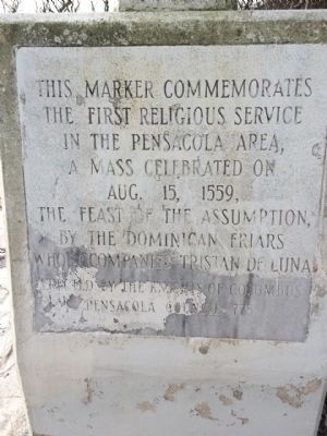
2. Original Cross of Marker on sand dune.
Photographed by Mark Hilton, January 1, 2015
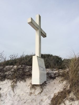
3. Cross that notes location of mass.
Photographed by Mark Hilton, December 31, 2014
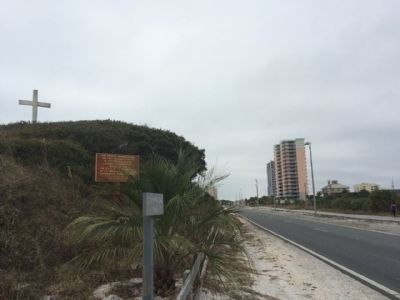
4. Marker and Cross wide area photo.
Credits. This page was last revised on November 16, 2017. It was originally submitted on January 1, 2015, by Mark Hilton of Montgomery, Alabama. This page has been viewed 1,504 times since then and 124 times this year. Photos: 1, 2, 3, 4. submitted on January 1, 2015, by Mark Hilton of Montgomery, Alabama.
