Near Pensacola Beach in Escambia County, Florida — The American South (South Atlantic)
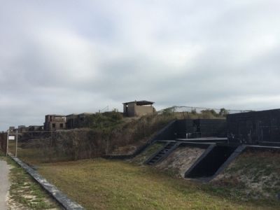
Battery Van Swearingen
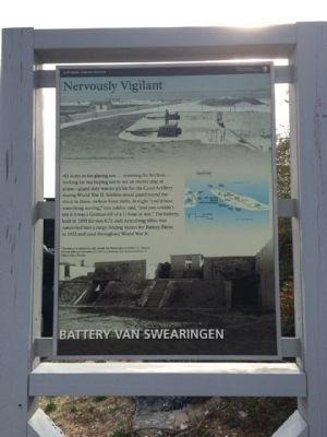
Nervously Vigilant
| — | Fort Pickens | — |
Photographed by Mark Hilton, December 31, 2014
1. Battery Van Swearingen Marker
All alone in the glaring sun...scanning the horizon...looking for but hoping not to see an enemy ship or plane—guard duty was no picnic for the Coast Artillery during World War II. Soldiers stood guard around the clock in three- or four-hour shifts. At night "you'd hear something moving," one soldier said, "and you couldn't tell if it was a German off a U-Boat or not." The battery, built in 1898 for two 4.72-inch Armstrong rifles, was converted into a range-finding station for Battery Payne in 1922 and used throughout World War II.
This battery was named for Capt. Joseph Van Swearingen of the 6th U.S. Infantry. He was killed on December 25, 1837, in a skirmish with Seminole Indians at Okeechobee, Florida.
Erected by the National Park Service, Department of the Interior.
Topics. This historical marker is listed in these topic lists: Forts and Castles • War, World II. A significant historical month for this entry is December 1833.
Location. 30° 19.653′ N, 87° 17.716′ W. Marker is near Pensacola Beach, Florida, in Escambia County. It is on Fort Pickens Road 10½ miles west of Pensacola Beach Boulevard (State Road 399),
this page online

Regionally, this marker is in Greater Pensacola and on the Florida Panhandle. It is also in the American South, specifically in the Deep South, and on the Gulf Coast. Globally, it is in the North Atlantic Region, North America, a Gulf of Mexico state, the Western Hemisphere, the Western World, and the Anglosphere. Historically, it finds itself in what was once New Spain, the territory of the Mississippian Culture, one of the Confederate States of America, and the Antebellum South.
Other nearby markers. At least 8 other markers are within walking distance of this marker: Battery Payne (within shouting distance of this marker); Battery Cullum, Battery Sevier (about 500 feet away); Colonial Power Struggle (approx. 0.2 miles away); Hurricane Ivan (approx. 0.2 miles away); From the Fort to these Wooden Buildings (approx. 0.2 miles away); Battery Trueman (approx. ¼ mile away); Massive Smoothbore (approx.
Photographed by Mark Hilton, December 31, 2014
2. Battery Van Swearingen
Another marker is no longer nearby. Battery Langdon (was about 400 feet away, measured in a direct line but has been confirmed missing).
Also see . . . Fort Wiki article on Battery Van Swearingen. (Submitted on January 2, 2015, by Mark Hilton of Montgomery, Alabama.)
Photographed by Mark Hilton, January 1, 2015
3. Fort Pickens entrance sign
Credits. This page was last revised on June 16, 2016. It was originally submitted on January 2, 2015, by Mark Hilton of Montgomery, Alabama. This page has been viewed 776 times since then and 46 times this year. Photos: 1, 2, 3. submitted on January 2, 2015, by Mark Hilton of Montgomery, Alabama.
