Sweet Spring
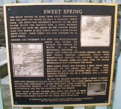
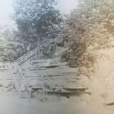
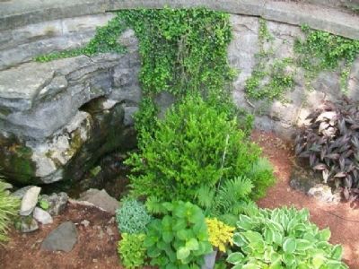
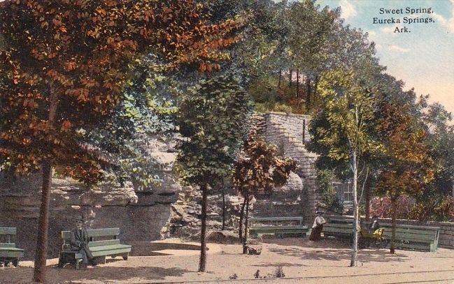
This spring derived its name from early townspeople who declared the water to have a pleasant, sweet taste. The spring was originally located in the deep ravine below the present site. A long wooden stairway led from the spring to the narrow wagon road then known as Rice Street, which is now called Spring Street. Sweet Spring was also referred to as Spout Spring.
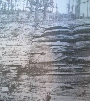
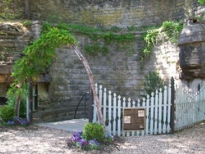
Around 1885 workmen dug into the mountainside above the street to locate the stream of water in a more accessible location. A stone lined circular enclosure around the spring, and finely pointed limestone walls were constructed against the hillside. The Waldrip brothers, William, James and John, were the skilled stonemasons who performed this work.
When Spring Street was widened, a small public area adjacent to the spring was set aside. Wide boardwalks and wood benches were built. A long wooden stairway led to a pathway and a street above the spring.
In 1916 the Waldrip brothers built a stone stairway inset with benches to replace the old wood steps. The Eureka Springs Women's Club funded these improvements, along with many other community beautification projects. A.O. Clark, who later designed the auditorium in 1928, was the architect for this project.
Sweet Spring and the wooded area above and below it were established by Ordinance No. 77 dated February
15, 1886 as a spring reservation, preserved for public use in perpetuity.Erected by Greater Eureka Springs Chamber of Commerce and the Community Development Partnership.
Topics. This historical marker is listed in these topic lists: Charity & Public Work • Settlements & Settlers • Waterways & Vessels. A significant historical date for this entry is February 15, 1886.
Location. 36° 24.275′ N, 93° 44.286′ W. Marker is in Eureka Springs, Arkansas, in Carroll County. Marker is on Spring Street east of Pine Street, on the left when traveling east. Touch for map. Marker is at or near this postal address: 124 Spring Street, Eureka Springs AR 72632, United States of America. Touch for directions.
Other nearby markers. At least 8 other markers are within walking distance of this marker. Sweet Spring Hotel - Huntington Infirmary - Sweet Spring Home (within shouting distance of this marker); Fire and Brick & Stone (within shouting distance of this marker); Elwood House (within shouting distance of this marker); Kentucky House (within shouting distance of this marker); Eastview Cottage (about 300 feet away, measured in a direct line); Harding Spring (about 400 feet away); The Lay of the Land (about 400 feet away); Citizen's Bank Building (about 700 feet away). Touch for a list and map of all markers in Eureka Springs.
Also see . . .
1. Eureka Springs History. (Submitted on January 4, 2015, by William Fischer, Jr. of Scranton, Pennsylvania.)
2. Eureka Springs at Encyclopedia of Arkansas History & Culture. (Submitted on January 4, 2015, by William Fischer, Jr. of Scranton, Pennsylvania.)
3. The Historic Springs of Eureka Springs, Arkansas. (Submitted on January 6, 2015, by William Fischer, Jr. of Scranton, Pennsylvania.)
Credits. This page was last revised on September 3, 2020. It was originally submitted on January 4, 2015, by William Fischer, Jr. of Scranton, Pennsylvania. This page has been viewed 800 times since then and 107 times this year. Photos: 1, 2, 3, 4, 5. submitted on January 4, 2015, by William Fischer, Jr. of Scranton, Pennsylvania. 6. submitted on November 16, 2015.
