Baxter Springs in Cherokee County, Kansas — The American Midwest (Upper Plains)
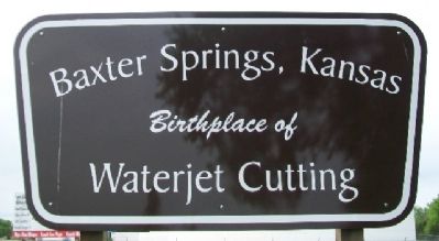
Baxter Springs, Kansas
Photographed by William Fischer, Jr., April 12, 2012
1. Baxter Springs, Kansas Marker
Topics. This historical marker is listed in this topic list: Industry & Commerce.
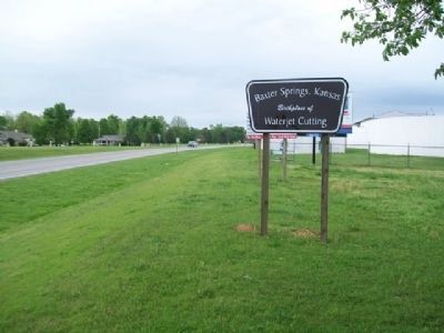
Location. 37° 2.163′ N, 94° 44.103′ W. Marker is in Baxter Springs, Kansas, in Cherokee County. It is on Military Avenue (U.S. 69), on the right when traveling south. Marker is in Military Park, opposite Baxter Springs High School. Touch for map. Marker is in this post office area: Baxter Springs KS 66713, United States of America. Touch for directions.

Regionally, this marker is in Eastern Kansas and specifically in Bleeding Kansas Border War Country. It is also in the American Midwest, in the Corn Belt, on the prairies, and on the Southern Plains. Globally, it is in North America, the Western Hemisphere, the Western World, and the Anglosphere. Historically, it finds itself in what was once New Spain and also the Louisiana Purchase.
Other nearby markers. At least 8 other markers are within walking distance of this marker: Baxter Springs Massacre 1863 (a few steps from this marker); Baxter Springs Massacre (a few steps from this marker); The Earliest Residents
this page online
Also see . . . Birth of the First Intensifier Pump Waterjet Cutting Machine. (Submitted on January 10, 2015, by William Fischer, Jr. of Reynoldsburg, Ohio.)
Photographed by William Fischer, Jr., April 12, 2012
2. Baxter Springs, Kansas Marker
Credits. This page was last revised on May 7, 2021. It was originally submitted on January 10, 2015, by William Fischer, Jr. of Reynoldsburg, Ohio. This page has been viewed 877 times since then and 52 times this year. Photos: 1, 2. submitted on January 10, 2015, by William Fischer, Jr. of Reynoldsburg, Ohio.
