Great Falls in Cascade County, Montana — The American West (Mountains)
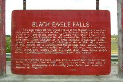
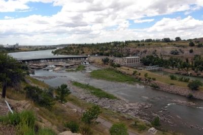
Black Eagle Falls
After viewing the falls, Capt. Lewis ascended the hill to the former location of the smelter stack and saw “... in these plains and more particularly in the valley just below me immence herds of buffaloe ...”
Topics and series. This historical marker is listed in these topic lists: Exploration • Waterways & Vessels. In addition, it is included in the Lewis & Clark Expedition series list. A significant historical month for this entry is June 1867.
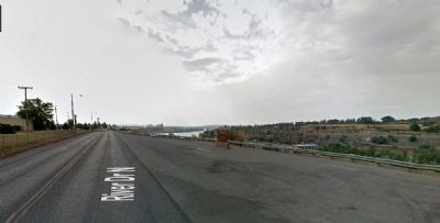
Location. This marker has been replaced by another marker nearby. 47° 31.178′ N, 111° 15.446′ W. Marker is in Great Falls, Montana, in Cascade County . Marker is on River Drive North, 0.4 miles east of 25th Street North, on the right when traveling west. Touch for map. Marker is in this post office area: Great Falls MT 59401, United States of America. Touch for directions.
Other nearby markers. At least 8 other markers are within 2 miles of this location, measured as the crow flies. Ursuline Academy (approx. 1.1 miles away); Mobile Villages (approx. 1.2 miles away); Seaman: Companion to the Corps (approx. 1.2 miles away); The Experiment (approx. 1.2 miles away); A "great" Set of Falls (approx. 1.3 miles away); The Army's Navy (approx. 1.3 miles away); One of Many Firsts (approx. 1.4 miles away); Of Special Concern (approx. 1.4 miles away). Touch for a list and map of all markers in Great Falls.
Additional commentary.
1. Replacement Marker
The marker was replaced in October 2011 with a new marker of similar size and shape in the same location. The new marker, titled "Black Eagle", modified the text of the previous marker and added substantial information on the smelter complex and communities across the river.
— Submitted January 21, 2015.
Credits. This page was last revised on June 16, 2016. It was originally submitted on January 21, 2015, by Duane Hall of Abilene, Texas. This page has been viewed 490 times since then and 22 times this year. Photos: 1, 2, 3. submitted on January 21, 2015, by Duane Hall of Abilene, Texas.


