Riverside in Buffalo in Erie County, New York — The American Northeast (Mid-Atlantic)
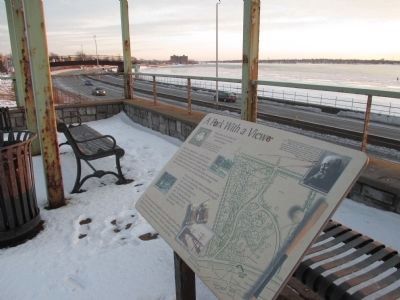
Park with a View
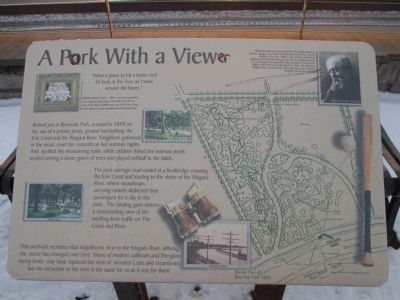
"What a place to hit a home run! I'd look at the river as I went around the bases."
Buffalo Baseball Team - 1898: one of many teams who enjoyed practicing at Riverside Park for its view of the River. Buffalo was one of the first cities in the nation to have a professional baseball team. Photo courtesy of the Buffalo & Erie County Historical Society.
Behind you is Riverside Park, created in 1898 on the site of a private picnic ground overlooking the Erie Canal and the Niagara River. Neighbors gathered in the music court for concerts on hot summer nights and strolled the meandering trails, while children fished the minnow pools nestled among a dense grove of trees and played softball in the fields. Photo courtesy of the Buffalo & Erie County Historical Society.
The park carriage road ended at a footbridge crossing the Erie Canal and leading to the shore of the Niagara River, where steamboats carrying visitors delivered their passengers for a day in the park. The landing gave visitors a commanding view of the bustling boat traffic on The Canal and River. Photo courtesy of the Buffalo Olmsted Parks Conservancy.
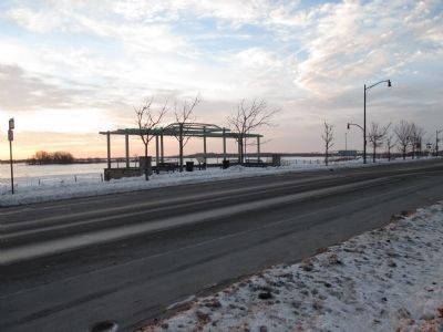
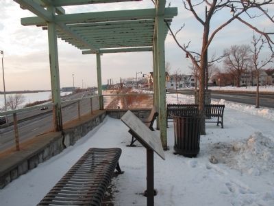
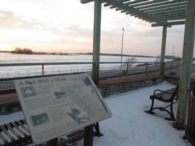
This overlook recreates that magnificent view to the Niagara River, although the scene has changed over time. Views of modern sailboats and fiberglass racing boats may have replaced the view of wooden boats and steamboats, but the attraction to the river is the same for us as it was for them. Steamboat landing. Master Plan of Riverside Park 1898.
Riverside Park was the last park in the public parkway system designed by Frederick Law Olmsted for the City of Buffalo in the late 1800's. The system of informal parklands and formal parkways met the recreational needs of a swelling urban population and provided a framework within which the city would grow. In 1982, the Olmsted Buffalo Parks and Parkways were placed on the National Register of Historic Places. Frederick Law Olmsted.
Topics. This historical marker is listed in these topic lists: Charity & Public Work • Environment. A significant historical year for this entry is 1898.
Location. 42° 57.349′ N, 78° 54.675′ W. Marker is in Buffalo, New York, in Erie County. It is in Riverside. Marker is at the intersection of Niagara Street (New York State Route 266) and Hotaling Drive, on the right when traveling south on Niagara Street. Marker is just south of the intersection at a fenced cement viewing platform. Touch for map. Marker is in this post office area: Buffalo NY 14207, United States of America. Touch for directions.
Other nearby markers. At least 8 other markers are within 2 miles of this marker, measured as the crow flies. Erected by the Grateful People (within shouting distance of this marker); In Memory of the Sons and Daughters (about 300 feet away, measured in a direct line); Bernard G. Hitro Jr.
(approx. ¼ mile away); Hunting and Fishing off the Porch (approx. 0.6 miles away); Niagara River Corridor / Avian Walk (approx. 0.6 miles away); The Niagara River (approx. 0.7 miles away); Tow Path Park (approx. 1.1 miles away); The Fenian Invasion of 1866 (approx. 1.1 miles away). Touch for a list and map of all markers in Buffalo.
Also see . . .
1. Riverside Park - Olmsted in Buffalo. (Submitted on January 26, 2015, by Anton Schwarzmueller of Wilson, New York.)
2. Riverside Park. National Register of Historic Places form, National archives. (Submitted on September 18, 2023, by Anton Schwarzmueller of Wilson, New York.)
Credits. This page was last revised on September 18, 2023. It was originally submitted on January 26, 2015, by Anton Schwarzmueller of Wilson, New York. This page has been viewed 429 times since then and 12 times this year. Photos: 1, 2, 3, 4, 5. submitted on January 26, 2015, by Anton Schwarzmueller of Wilson, New York.
