Near Vinemont in Morgan County, Alabama — The American South (East South Central)
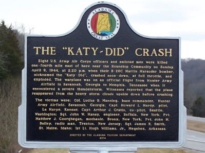
The "Katy-Did" Crash
Eight U.S. Army Air Corps officers and enlisted men were killed one-fourth mile east of here near the Roundtop Community on Sunday, April 9, 1944, at 2:20 p.m. when their B-26C Martin Marauder bomber, nicknamed the “Katy-Did”, crashed nose-down, at full throttle, and exploded. The warplane was on an official flight from Hunter Army Airfield in Savannah, Georgia to Memphis, Tennessee when it encountered a severe thunderstorm. Witnesses reported that the plane reappeared from the heavy storm clouds upside down before crashing.
The victims were: Col. Lucius B. Manning, base commander, Hunter Army Airfield, Savannah, Georgia; Capt. Howard L. Hardy, pilot, La Harpe, Kansas; Capt. Arthur J. Gratis, co-pilot, Seattle, Washington; Sgt. John W. Haney, engineer, Buffalo, New York; Pvt. Matthew J. Georghegan, mechanic, Bronx, New York; Pvt. John H. Bailey, radio man, Trenton, New Jersey; Sgt. James R. Smith, St. Maire, Idaho; 1st Lt. Hugh Williams, Jr., Megehee, Arkansas.
Erected 2014 by Alabama Tourism Department.
Topics. This historical marker is listed in these topic lists: Air & Space • Disasters • War, World II. A significant historical date for this entry is April 9, 1832.
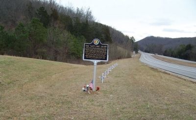
Location. 34° 19.467′ N, 87° 0.08′ W. Marker is near Vinemont, Alabama, in Morgan County. Marker is on University of North Alabama Highway (Alabama Route 157 at milepost 19), 0.4 miles south of State Crusher Road, on the right when traveling north. Touch for map. Marker is in this post office area: Vinemont AL 35179, United States of America. Touch for directions.
Other nearby markers. At least 8 other markers are within 9 miles of this marker, measured as the crow flies. Battleground (approx. 1˝ miles away); Cedar Plains Christian Church (approx. 2.8 miles away); McKendree Cemetery and the Massey Community / Charles Christopher Sheats 1839-1904 (approx. 3.4 miles away); Original Falkville Town Hall Building / Falkville Water Tower (approx. 6.2 miles away); Battle of Day’s Gap (approx. 6.6 miles away); Streight’s Raid (approx. 8.1 miles away); a different marker also named Streight’s Raid (approx. 8.1 miles away); Where does your drinking water come from? (approx. 8.1 miles away). Touch for a list and map of all markers in Vinemont.
Also see . . . Cullman Times article about marker dedication. (Submitted on January 25, 2017, by Mark Hilton of Montgomery, Alabama.)
Credits. This page was last revised on January 27, 2017. It was originally submitted on January 31, 2015, by David J Gaines of Pinson, Alabama. This page has been viewed 4,683 times since then and 612 times this year. Photos: 1, 2. submitted on January 31, 2015, by David J Gaines of Pinson, Alabama. • Bernard Fisher was the editor who published this page.

