Percé in Le Rocher-Percé, Québec — Central Canada (French-Canadian)
A Rock Forever Sculpted by Time and Tide
Un rocher sans cesse sculpté, au fil du temps et des marées
| — | Parc National de l’Île-Bonaventure-et-du-Rocher-Percé | — |
Photographed by Barry Swackhamer, July 17, 2014
1. A Rock Forever Sculpted by Time and Tide Marker
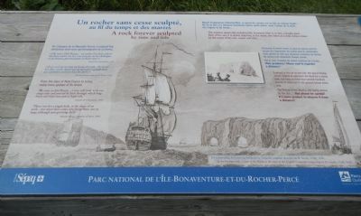
Captions (English / French): In the background, a view of the Rock at the time of the English Conquest (engraving by H. Smith, 1760) / En arrière plan, le rocher au temps de la Conquête anglaise (gravure de H. Smith, 1760); (center) Collapsed pillar in 1951 / Arcade dans la tour effondrée en 1951
From the days of New France to today, many have spoken of its shape.
“We came to Isle Percée… a very tall rock, with two steep sides and pierced by hole through which long boats and ships may pass at high tide.” Samuel de Champlain, 1603
There was but a single hole in the shape of an arch… two more have come into being since, not as large though now growing daily. Nicolas Denys, Seigneur of Percé, 1686
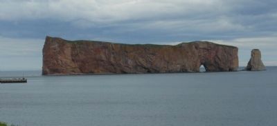
This massive apparently indestructible limestone titan is, in fact, a fragile giant… Born of the sea, it is slowly returning to the water, one stone at a time, broken down by the action of the rain, waves and time…
Exposed to the air at low tide, the gravel bridge allows visitors to approach the Rock for a closer look, but keep in mind that several hundred tonnes of stone fall to the ground below every year.
The history of the Rock is still being written by the sea… But please be careful! It’s more prudent to observe it from a distance!
French:
De l’époque de la Nouvelle-France à aujourd’hui, nombreux sont ceux qui témoignent de sa forme.
«On vint a l’Isle Percée… un rocher fort haut, eslevé des deux cotez, où il y'a un trou par où les chaloupes et les bateaux peuvent passer den haute mer.» Samuel
this page online
«Il n’y avait qu’un trou en forme d’arcade… Il s’en est fait deux autres depuis qui ne sont pas si grands mais qui à présent croissent tous les jours.» Nicolas Denys, seigneur de Percé, 1686
Massif d’apparence indestructible, ce géant de calcaire est en fait un colosse fragile… Né de la mer, il y retourne lentement, pierre après pierre, sous l’action de la pluie, des vagues et du temps…
Découvert à marée basse, le pont de pierres permet encore de s’approcher du rocher pour le contempler, mais gardez en tête que plusieurs centaines de tonnes de roches s’en détachent chaque année.
Par la mer, l’histoire du rocher continue de s’écrire… Mais prudence! Mieux vaut le regarder à distance!
Erected by Parcs Québec.
Topics. This historical marker is listed in this topic list: Landmarks. A significant historical year for this entry is 1603.
Location. 48° 31.503′ N, 64° 12.386′ W. Marker is in Percé, Québec, in Le Rocher-Percé. It can be reached from Rue du Mont Joli close to Québec Route 132. Touch for map. Marker is at or near this postal address: 38 Rue du Mont Joli, Percé QC G0C 2L0, Canada. Touch for directions.

Regionally,
Photographed by Barry Swackhamer, July 17, 2014
2. A Rock Forever Sculpted by Time and Tide Marker
Other nearby markers. At least 7 other markers are within 13 kilometers of this marker, measured as the crow flies: Artistes (approx. 0.3 kilometers away); William Edmond Logan (approx. 0.4 kilometers away); Percé Great War Memorial (approx. 0.4 kilometers away); Percé World War II Monument (approx. 0.4 kilometers away); 350ᵉ anniversaire de la visite de François de Montmorency-Laval (approx. half a kilometer away); Edmund James Flynn (approx. half a kilometer away); War Memorial (approx. 11.6 kilometers away).
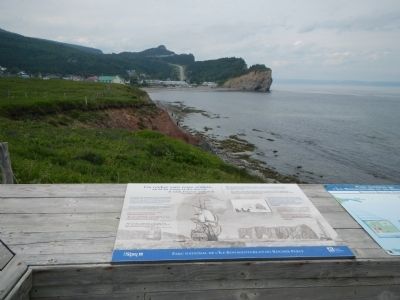
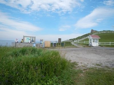
More about this marker. This marker is located at the entrance to the Percé Rock overlook.
Also see . . . Percé Rock - Wikipedia. The massive rocky cliff is called by several names, such as le Rocher Percé, Pierced Rock, Pierced Island, Split Rock or Percé Rock. The name is attributed to the pierced rock that formed an arch of 15 metres (49 ft) height on its seaward southern end, as though a needle had cut through the rock. It was named Percé ("pierced rock") by Samuel de Champlain in 1607, in reference to the holes he had seen in the massive block of limestone, which over the years has become a major attraction in the region of Quebec.
Photographed by Barry Swackhamer, July 17, 2014
3. Entrance to the Percé Rock overlook
Photographed by Barry Swackhamer, July 17, 2014
4. Percé Rock
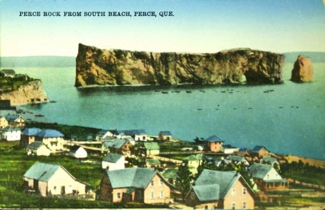
Postcard by Novelty Mfg. & Art Co., Ltd., circa 1920
5. Perce Rock from South Beach, Perce, Que.
Credits. This page was last revised on April 18, 2021. It was originally submitted on February 6, 2015, by Barry Swackhamer of Brentwood, California. This page has been viewed 512 times since then and 37 times this year. Photos: 1, 2, 3, 4. submitted on February 6, 2015, by Barry Swackhamer of Brentwood, California. 5. submitted on February 6, 2015. • Andrew Ruppenstein was the editor who published this page.
