Fort Washington in Prince George's County, Maryland — The American Northeast (Mid-Atlantic)
Minefields
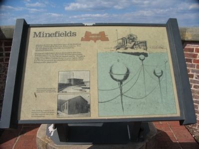
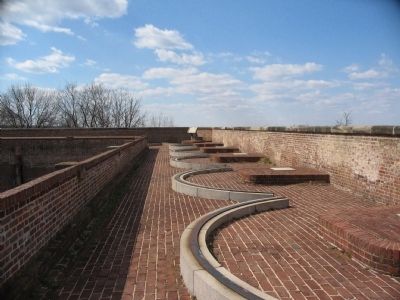
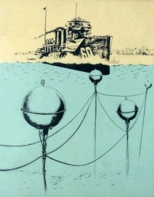
Groups of underwater mines anchored in the river downstream from the fort could be fired electrically from here when enemy ships passed nearby. The guns of Batteries White (visible below to your right), Many, and Smith protected the minefield from enemy minesweepers and destroyers.
Topics. This historical marker is listed in these topic lists: Forts and Castles • Military.
Location. 38° 42.658′ N, 77° 2.145′ W. Marker is in Fort Washington, Maryland, in Prince George's County. Marker can be reached from Fort Washington Road, on the right when traveling south. Located in Fort Washington Park, on the southwest demi-bastion. Touch for map. Marker is at or near this postal address: 13551 Fort Washington Road, Fort Washington MD 20744, United States of America. Touch for directions.
Other nearby markers. At least 8 other markers are within walking distance of this marker. Shot and Shell (within shouting distance of this marker); Counterscarp Battery (within shouting distance of this marker); Water Battery (within shouting distance of this marker); The Cisterns (within shouting distance of this marker); New Guns for an Old Fort (about 300 feet away, measured in a direct line); Caponiere (about 300 feet away); a different marker also named The Water Battery (about 400 feet away); The Northwest Demi-Bastion (about 500 feet away). Touch for a list and map of all markers in Fort Washington.
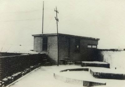
More about this marker. The marker displays two photographs on the lower left below the text. The upper photograph details This building housed the plotting instrument and controls for the minefield, and shows a structure in the angle of the demi-bastion where the marker stands today.
The lower photograph is captioned: This building, located on the lower level, housed the generator that supplied the power for the minefield. To the right is a drawing of the mine field as it looked in place in the river.
Also see . . .
1. Fort Washington. National Park Service site. (Submitted on June 1, 2008, by Craig Swain of Leesburg, Virginia.)
2. U.S. Naval Mines. Page detailing the types of mines used by the United States, past and present. (Submitted on June 1, 2008, by Craig Swain of Leesburg, Virginia.)

Photographed By Craig Swain, March 1, 2008
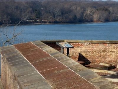
4. Minefield Location
Looking downstream from the fort, defenders would have placed the mines in the channel to the south. The intent, aside from disabling or sinking enemy ships, was to cause confusion and force radical maneuvers which reduced the enemy's accuracy.
Credits. This page was last revised on June 16, 2016. It was originally submitted on June 1, 2008, by Craig Swain of Leesburg, Virginia. This page has been viewed 930 times since then and 15 times this year. Photos: 1, 2. submitted on June 1, 2008, by Craig Swain of Leesburg, Virginia. 3. submitted on July 26, 2014, by Allen C. Browne of Silver Spring, Maryland. 4. submitted on June 1, 2008, by Craig Swain of Leesburg, Virginia. 5, 6, 7. submitted on July 26, 2014, by Allen C. Browne of Silver Spring, Maryland.
