Gaspé in La Côte-de-Gaspé, Québec — Central Canada (French-Canadian)
Jacques Cartier at Gaspe
Jacques Cartier à Gaspé
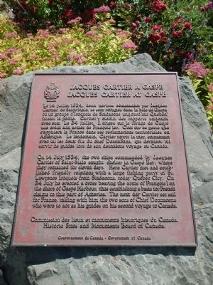
On 14 July 1534, the two ships commanded by Jacques Cartier of Saint-Malo sought shelter in Gaspé Bay, where they remained for eleven days. Here Cartier met and established friendly relations with a large fishing party of St. Lawrence Iroquois from Stadacona, today Québec City. On 24 July he erected a cross bearing the arms of François I on the shore of Gaspé Harbour, thus establishing a basis for French claims to this part of America. The next day Cartier set sail for France, taking with him the two sons of Chief Donnacona who were to act as his guides on his second voyage to Canada.
French:
Le 14 juillet 1534, deux navires commandés par Jacques Cartier, de Saint-Malo, se sont réfugiés dans la baie de Gaspé, où un groupe d'Iroquois de Stadaconé (aujourd'hui Québec) faisait la pêche. Cartier y établit des rapports amicaux avec eux. Le 24 juillet, il érigea sur le rivage de Gaspé une croix aux armes de François Ier. C'est sur ce geste que s'appuiera la France dans ses réclamations territoriales en Amérique. Le lendemain, Cartier reprit la mer, emmenant avec lui les deux fils du chef Donnacona, qui devaient lui servir de guides lors de son deuxième voyage au Canada.
Erected by Historic Sites and Monument Board of Canada/Commission de lieux et monuments historique du Canada.
Topics and series. This historical marker is listed in this topic list: Exploration. In addition, it is included in the Canada, Historic Sites and Monuments Board series list. A significant historical date for this entry is July 14, 1534.
Location. 48° 50.247′ N, 64° 28.507′ W. Marker is in Gaspé, Québec, in La Côte-de-Gaspé. Marker can be reached from Boulevard de Gaspé (Québec Route 132). Touch for map. Marker is at or near this postal address: 115 Boulevard de Gaspé, Gaspé QC G4X 1A9, Canada. Touch for directions.
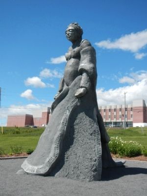
Other nearby markers. At least 3 other markers are within walking distance of this marker. Jacques Cartier Monument (within shouting distance of this marker); Rodolphe Lemieux (approx. 0.9 kilometers away); Jacque Cartier (approx. 1.3 kilometers away).
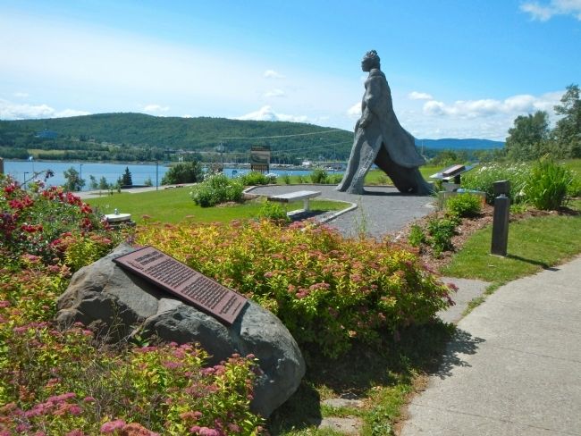
More about this marker. The marker is locate at the Promenade Jacques-Cartier near the parking lot.
Also see . . . Jacques Cartier - Wikipedia. Having already located the entrance to the St. Lawrence on his first voyage, he now opened up the greatest waterway for the European penetration of North America. He produced an intelligent estimate of the resources of Canada, both natural and human, albeit with a considerable exaggeration of its mineral wealth. While some of his actions toward the St. Lawrence Iroquoians were dishonourable, he did try at times to establish friendship with them and other native peoples living along the St. Lawrence River—an indispensable preliminary to French settlement in their lands. (Submitted on February 7, 2015, by Barry Swackhamer of Brentwood, California.)
Credits. This page was last revised on April 18, 2021. It was originally submitted on February 7, 2015, by Barry Swackhamer of Brentwood, California. This page has been viewed 468 times since then and 46 times this year. Photos: 1, 2, 3, 4. submitted on February 7, 2015, by Barry Swackhamer of Brentwood, California. • Andrew Ruppenstein was the editor who published this page.


