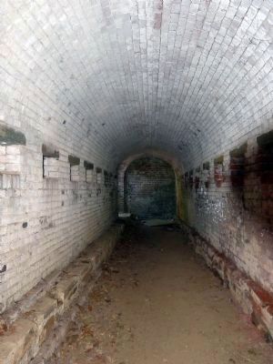
Fort Washington in Prince George's County, Maryland — The American Northeast (Mid-Atlantic)
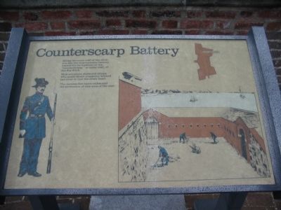
Counterscarp Battery
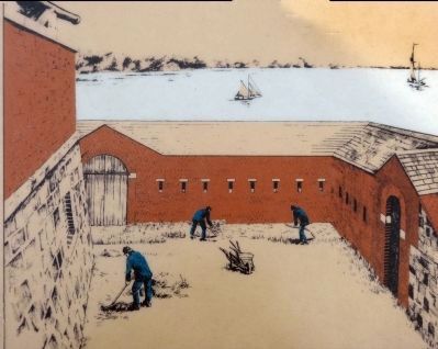
This structure sheltered troops who could direct musketry toward the river or into the ditch itself.
The reverse fire tactic enhanced the protection of this area of the wall.
Topics. This historical marker is listed in these topic lists: Forts and Castles • Military.
Location. 38° 42.635′ N, 77° 2.132′ W. Marker is in Fort Washington, Maryland, in Prince George's County. Marker can be reached from Fort Washington Road, on the right when traveling south. Located in Fort Washington Park, overlooking the counterscarp battery. Touch for map. Marker is at or near this postal address: 13551 Fort Washington Road, Fort Washington MD 20744, United States of America. Touch for directions.
Other nearby markers. At least 8 other markers are within walking distance of this marker. The Cisterns (a few steps from this marker); Minefields (within shouting distance of this marker); Shot and Shell (within shouting distance of this marker); Water Battery (within shouting distance of this marker); Caponiere (about 300 feet away, measured in a direct line); New Guns for an Old Fort (about 400 feet away); The Northwest Demi-Bastion (about 500 feet away); a different marker also named The Water Battery (about 500 feet away). Touch for a list and map of all markers in Fort Washington.
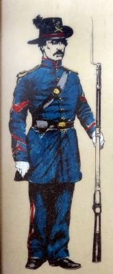
More about this marker. On the left is an illustration of an infantry soldier in a pre-Civil War uniform. The illustration on the right shows the garrison soldiers maintaining the grounds inside the counterscarp battery. An overhead plan of the fort indicates the location of the marker.
Also see . . . Fort Washington. National Park Service site. (Submitted on June 1, 2008, by Craig Swain of Leesburg, Virginia.)
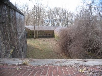
Photographed By Craig Swain, March 1, 2008
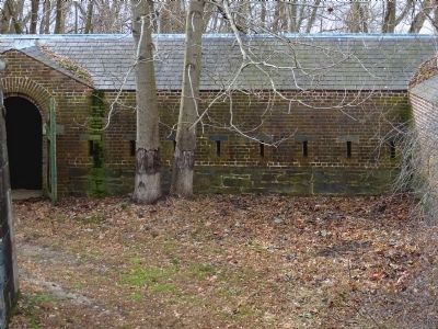
2. View of the Battery from the Marker Location
This view is very similar to that illustrated on the marker. Despite the overgrowth, the masonry works still stand. Note the firing slits, seen as very narrow "windows" in the brick, providing a field of fire against any enemy who has compromised the outer works.
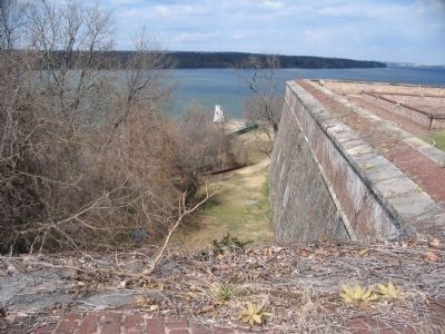
Photographed By Craig Swain, March 1, 2008
3. Outer Works in Front of the Fort
This view looks at the opposite wall, toward the river side or front of the fort. The counterscarp is completely hidden under the fort wall from this view, illustrating the blind spot of the fort, which the outer works protected.
Credits. This page was last revised on June 16, 2016. It was originally submitted on June 1, 2008, by Craig Swain of Leesburg, Virginia. This page has been viewed 1,019 times since then and 30 times this year. Photos: 1, 2, 3. submitted on June 1, 2008, by Craig Swain of Leesburg, Virginia. 4, 5, 6, 7, 8. submitted on July 26, 2014, by Allen C. Browne of Silver Spring, Maryland.
