Haute-Ville in Québec in Communauté-Urbaine-de-Québec, — Central Canada (French-Canadian)
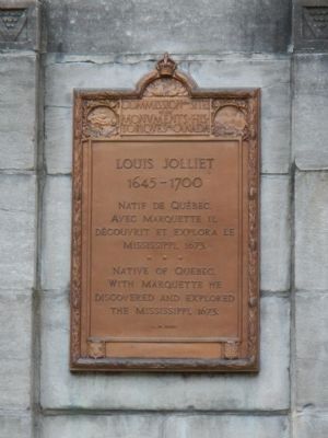
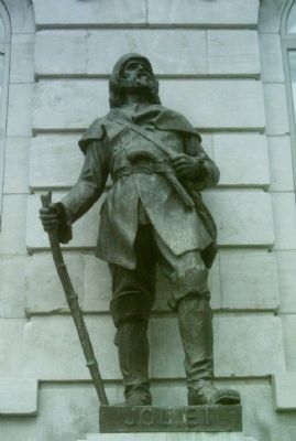
Louis Jolliet
1645-1700
English:
Erected 1947 by Historic Sites and Monument Board of Canada/Commission de sites et des monuments historiques du Canada.
Topics and series. This historical marker is listed in this topic list: Exploration. In addition, it is included in the Canada, Historic Sites and Monuments Board series list. A significant historical year for this entry is 1673.
Location. 46° 48.747′ N, 71° 12.223′ W. Marker is in Québec, in Communauté-Urbaine-de-Québec. It is in Haute-Ville. Marker is on Rue du Petit Champlain close to Rue Sous le Fort, on the right when traveling south. Touch for map. Marker is at or near this postal address: 24 Rue du Petit Champlain, Québec G1K 4G8, Canada. Touch for directions.
Other nearby markers. At least 8 other markers are within walking distance of this marker. Funiculaire / Funicular (here, next to this marker); Louis Jolliet House (a few steps from this marker); Hommage à Pierre et Gabriel LeMieux (within shouting distance of this marker); L'Immigration des Filles du Roi en Nouvelle-France / Immigration of the Filles du Roi to New France (within shouting distance of this marker); Mathieu d'Amours (within shouting distance of this marker); Hôtel Chevalier (within shouting distance of this marker); Maison Jean-Demers (within shouting distance of this marker); Champlain Monument (within shouting distance of this marker). Touch for a list and map of all markers in Québec.
More about this marker. The marker is to the left of the funiculaire.
Also see . . . Louis Jolliet - Virtual Museum of New France. The journey by canoe to the Mississippi began in mid-May, 1673. One month later, the Mississippi unfurled before the canoeists. Turning southward, they paddled downstream until they reached the area that is today the boundary between Louisiana and Arkansas. In the middle of July, fearing “to deliver themselves to the Spaniards of Florida if they advanced further,” Jolliet and Marquette resolved to return the way they had come. They were disappointed not to have reached the mouth of the river, but they had established that the Mississippi did indeed discharge its waters into the Gulf of Mexico. They noted the existence of other rivers flowing westwards, clinging to the belief that they flowed into the Sea of Japan or the China Sea. (Submitted on February 13, 2015, by Barry Swackhamer of Brentwood, California.)
Credits. This page was last revised on February 9, 2023. It was originally submitted on February 13, 2015, by Barry Swackhamer of Brentwood, California. This page has been viewed 466 times since then and 27 times this year. Photos: 1, 2, 3. submitted on February 13, 2015, by Barry Swackhamer of Brentwood, California. • Andrew Ruppenstein was the editor who published this page.


