Konza Prairie
Konza Prairie Research Natural Area
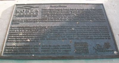
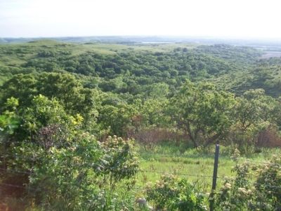
Konza Prairie Research Natural Area is an 8,600 acre tallgrass prairie preserve owned by The Nature Conservancy and managed by the Division of Biology at Kansas State University. You are standing on the northeast corner of the site which stretches south for five miles to Interstate 70 and four miles west. The Konza Prairie is one of the largest land tracts in North America dedicated to research on the ecological processes that characterize and maintain the tallgrass prairie. Research at the site is supported by Kansas State University, The Nature Conservancy, the Kansas Agricultural Experimental Science Foundation, and numerous other agencies.
Major research programs involve the primary forces that shape the prairie - fire, grazing by large mammals, and climate. Over 50 watersheds on Konza Prairie are systematically burned. Burning occurs at variable frequencies (every 1, 2, 4, 10, or 20 years) and during different seasons. Burning is used to analyze how the natural phenomenon of fire affects and sustains the tallgrass prairie. In addition, native bison and domestic livestock graze selected watersheds to determine how the interaction of grazers and fire influence the biological diversity and productivity of the prairie ecosystem. Researchers from across the United States and the world come to Kansas State University to study
soils; hydrology; and plant, insect, bird, and mammal populations in the Konza's unique living laboratory.
Access to Konza Prairie is limited due to the ongoing scientific research and the presence of bison. However, a public nature trail is open daily from dawn to dusk, accessible from the preserve entrance 6 miles south of Manhattan on McDowell Creek Road.
Erected 1997 by The Nature Conservancy and the Kansas State University Division of Biology.
Topics. This historical marker is listed in this topic list: Environment.
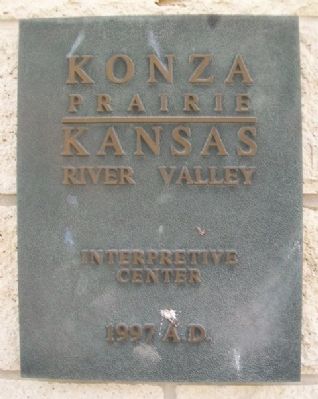
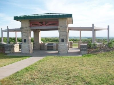
Location. 39° 7.95′ N, 96° 32.347′ W. Marker is near Manhattan, Kansas, in Riley County. Marker is on Pillsbury Drive (State Highway 177) 5 miles north of Interstate 70, on the left when traveling north. Marker is at the Konza Prairie-Kansas River Valley Interpretive Center. Touch for map. Marker is at or near this postal address: 3700 Pillsbury Drive, Manhattan KS 66502, United States of America. Touch for directions.
Other nearby markers. At least 8 other markers are within 4 miles of this marker, measured as the crow flies. Geology at Konza (here, next to this marker); The Tallgrass Prairie (about 300 feet away, measured in a direct line); Manhattan's Union Pacific Depot - Revived (approx. 3.2 miles away); Yuma Street (approx. 3.2 miles away); Change & Growth (approx.
Also see . . .
1. Konza Prairie. Kansas State University website entry (Submitted on February 13, 2015, by William Fischer, Jr. of Scranton, Pennsylvania.)
2. K-177 Overlook Park. Riley County website entry (Submitted on February 13, 2015, by William Fischer, Jr. of Scranton, Pennsylvania.)
Credits. This page was last revised on February 1, 2022. It was originally submitted on February 13, 2015, by William Fischer, Jr. of Scranton, Pennsylvania. This page has been viewed 421 times since then and 17 times this year. Photos: 1, 2, 3, 4, 5. submitted on February 13, 2015, by William Fischer, Jr. of Scranton, Pennsylvania.
