Haute-Ville in Québec in Capitale-Nationale, — Central Canada (French-Canadian)
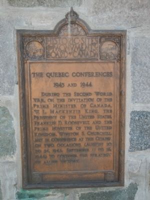
The Quebec Conferences
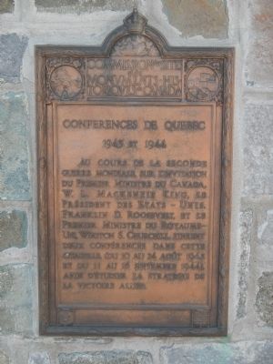
Conferences de Quebec
| — | 1943 and/ et 1944 | — |
Photographed by Barry Swackhamer, July 25, 2014
1. The Quebec Conferences Marker
During the Second World War, on the invitation of the Prime Minister of Canada, W.L. Mackenzie King, the President of the United States, Franklin D. Roosevelt, and the Prime Minister of the United Kingdom, Winston S. Churchill, met in conference at this Citadel on two occasions (August 10 to 24, 1943 and September 11 to 16, 1944) to consider the strategy of allied victory.
French:
Au cours de la seconde guerre mondiale, sur l'invitation du Premier-Ministre du Canada W. L. Mackenzie King, le Président des États-Unis, Franklin D. Roosevelt, et le Premier Ministre du Royaume-Uni, Winston S. Churchill, tinrent deux conférences dans cette citadelle, (du 10 au 24 août 1943 et du 11 au 16 septembre 1944), afin d'étudier la stratégie de la victoire alliée.
Erected by Historic Sites and Monument Board of Canada/Commission de lieux et monuments historique du Canada.
Topics and series. This historical marker is listed in this topic list: War, World II. In addition, it is included in the Canada, Historic Sites and Monuments Board, and the Former U.S. Presidents: #32 Franklin D. Roosevelt series lists. A significant historical month for this entry is September 1877.
Location. 46° 48.456′ N,
this page online

Regionally, this marker is in Central Canada. Globally, it is in North America, the Western Hemisphere, and the Western World. Historically, it finds itself in what was once a British colony, the Viceroyalty of New France, the Haudenosaunee (Iroquois) Confederacy, and Rupert’s Land.
Other nearby markers. At least 8 other markers are within walking distance of this marker: The Québec Citadel (here, next to this marker); Georges-Philias Vanier (within shouting distance of this marker); Chief Warrant Officier Jean Couture, OMN, CD (about 120 meters away, measured in a direct line); Cove Fields (approx. 0.2 kilometers away); Un site de choix pour fonder Québec / An Ideal Site to Found Québec (approx. 0.3 kilometers away); The Têtu House (approx. 0.3 kilometers away); General Montgomery’s Army (approx. 0.3 kilometers away); The Québec Garrison Club (approx.
Photographed by Barry Swackhamer, July 25, 2014
2. The Conferences de Quebec Marker
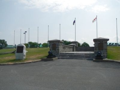
More about this marker. This marker is inside the Citadel near the parade grounds.
Photographed by Barry Swackhamer, July 25, 2014
3. The Quebec Conferences Marker
Credits. This page was last revised on February 9, 2023. It was originally submitted on February 14, 2015, by Barry Swackhamer of Brentwood, California. This page has been viewed 477 times since then and 21 times this year. Photos: 1, 2, 3. submitted on February 14, 2015, by Barry Swackhamer of Brentwood, California. • Andrew Ruppenstein was the editor who published this page.
