Haute-Ville in Québec in Capitale-Nationale, — Central Canada (French-Canadian)
Georges-Philias Vanier
(1888-1967)
Photographed by Barry Swackhamer, July 25, 2014
1. Georges-Philias Vanier Marker
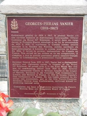
Governor General from 1959 to 1967, Vanier had a distinguished military and diplomatic career. A founder of the Royal 22e Régiment, he served with it in the First World War and was its commanding officer from 1925 to 1928. General Vanier represented Canada as military attaché to the League of Nations, Secretary to the Canadian High Commission in London, and minister to France. In 1944 he became Canada's first Ambassador to France. He was highly esteemed by his troops and countrymen, and as the first French-Canadian Governor General since Confederation, dedicated himself to promoting national unity.
French:
Gouverneur général de 1959 à 1967, Georges Vanier prit part à la première Grande Guerre dans le Royal 22e Régiment, dont il servit dans ses rangs durant la Première Guerre mondiale et en fut le commandant de 1925 à 1928. Il représenta le Canada comme attaché militaire à la Société des Nations, comme secrétaire du haut-commissariat à Londres et comme ministre en France. En 1944, il devint le premier ambassadeur du Canada en France. Très estimé de ses soldats et de ses compatriotes, il s'employa, à titre
this page online
Erected by Historic Sites and Monument Board of Canada/Commission de lieux et monuments historique du Canada.
Topics and series. This historical marker is listed in this topic list: War, World I. In addition, it is included in the Canada, Historic Sites and Monuments Board series list. A significant historical year for this entry is 1959.
Location. 46° 48.469′ N, 71° 12.435′ W. Marker is in Québec, in Capitale-Nationale. It is in Haute-Ville. It can be reached from Côte de la Citadelle. Touch for map. Marker is at or near this postal address: 1 Côte de la Citadelle, Québec G1R 3N9, Canada. Touch for directions.

Regionally, this marker is in Central Canada. Globally, it is in North America, the Western Hemisphere, and the Western World. Historically, it finds itself in what was once a British colony, the Viceroyalty of New France, the Haudenosaunee (Iroquois) Confederacy, and Rupert’s Land.
Other nearby markers. At least 8 other markers are within walking distance of this marker: The Québec Citadel (within shouting
Photographed by Barry Swackhamer, July 25, 2014
2. Georges-Philias Vanier Marker
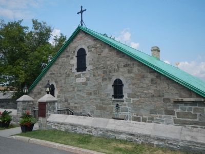
More about this marker. This marker is on the grounds of the Quebec Citadel near the Regimental Chapel.
Also see . . . Georges Vanier - Wikipedia. Vanier was the first French Canadian governor general of Canada, his bilingualism proving to be an asset to his mandate of fostering Canadian unity. Following on that of Vincent Massey, an Anglophone, the appointment of Vanier established the tradition of rotating between French and English speaking persons. (Submitted on February 15, 2015, by Barry Swackhamer of Brentwood, California.)
Photographed by Barry Swackhamer
3. Georges-Philias Vanier Marker
Credits. This page was last revised on February 9, 2023. It was originally submitted on February 15, 2015, by Barry Swackhamer of Brentwood, California. This page has been viewed 435 times since then and 14 times this year. Photos: 1, 2, 3. submitted on February 15, 2015, by Barry Swackhamer of Brentwood, California. • Andrew Ruppenstein was the editor who published this page.
