Vieux-Québec-Cap-Blanc-colline Parlementaire in Communauté-Urbaine-de-Québec, — Central Canada (French-Canadian)
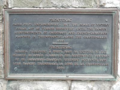
Frontenac
Faced Phips unflinchingly, but the scale of victory could not be turned decisively until the famous reinforcements of Carignan’s and French-Canadians marched in triumphantly along the Grande-Allée.
1690
Résista fièrement à Phips, mais sa victoire ne fut décisive qu’après l’arrivée des renforts de Carignan et de canadiens-français vivement acclames, dans leur marche triomphale le long de la Grande-Allée.
1690
Topics. This historical marker is listed in this topic list: War, French and Indian. A significant historical year for this entry is 1690.
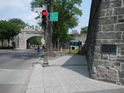
Location. 46° 48.541′ N, 71° 12.705′ W. Marker is in Québec, in Communauté-Urbaine-de-Québec. It is in Vieux-Québec-Cap-Blanc-colline Parlementaire. Marker is at the intersection of Rue Saint Louis and Avenue Honoré Mercier, on the right when traveling east on Rue Saint Louis. Touch for map. Marker is at or near this postal address: 117 Rue Saint Louis, Québec G1R 3R2, Canada. Touch for directions.
Other nearby markers. At least 8 other markers are within walking distance of this marker. Fortifications de / of Québec (within shouting distance of this marker); In Memory of Our Fallen Soldiers (within shouting distance of this marker); General Montgomery’s Army (within shouting distance of this marker); Les Conferences de Québec de 1943 et 1944 (about 90 meters away, measured in a direct line); The Québec Garrison Club (about 120 meters away); Quebec Boer War Memorial (about 120 meters away); Jonathan Sewell (about 150 meters away); Augustin-Norbert Morin (about 180 meters away). Touch for a list and map of all markers in Québec.
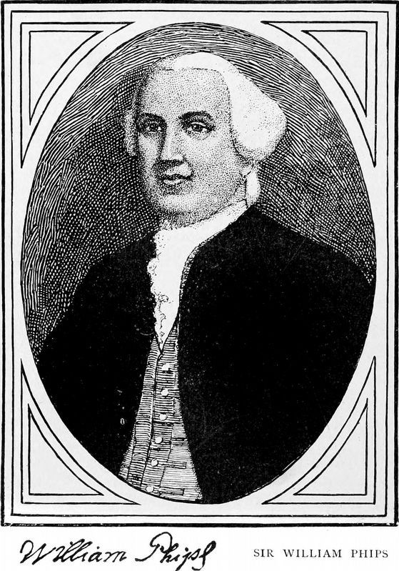
More about this marker. This marker makes reference to Sir William Phips attach upon Quebec during King William's War (1688-1697).
Also see . . .
1. Louis de Buade, Count de Palluau et de Frontenac - Dictionary of Canadian Biography. ...soldier, governor-general of New France; one of the more turbulent and influential figures in the history of Canada, chiefly noted as the architect of French expansion in North America and defender of New France against attacks by the Iroquois confederacy and the English colonies... (Submitted on February 15, 2015, by Barry Swackhamer of Brentwood, California.)
2. King William's War - Wikpedia. For King William's War, neither England nor France thought of weakening their position in Europe to support the war effort in North America. New France and the Wabanaki Confederacy were able to thwart New England expansion into Acadia, whose border New France defined as the Kennebec River in southern Maine. According to the terms of the Treaty of Ryswick, the boundaries and outposts of New France, New England, and New York remained substantially unchanged. (Submitted on February 15, 2015, by Barry Swackhamer of Brentwood, California.)
Credits. This page was last revised on February 9, 2023. It was originally submitted on February 15, 2015, by Barry Swackhamer of Brentwood, California. This page has been viewed 441 times since then and 16 times this year. Photos: 1, 2. submitted on February 15, 2015, by Barry Swackhamer of Brentwood, California. 3. submitted on September 3, 2020, by Allen C. Browne of Silver Spring, Maryland. • Andrew Ruppenstein was the editor who published this page.


