Capitol Hill in Southeast Washington in Washington, District of Columbia — The American Northeast (Mid-Atlantic)
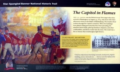
The Capitol in Flames
Star-Spangled Banner National Historic Trail
— National Park Service, U.S. Department of the Interior —
Temporary Quarters
The burning of the Capitol, where Congress had voted to declare war on Great Britain in June 1812, left the legislators homeless. So they reunited at the Patent Office, at seventh and F Streets, NW. On February 16, 1815, Congress ratified the Treaty of Ghent (and the war's end) at the Patent Office.
“I had no objection to burn[ing] arsenals, dockyards, frigates building, stores, barracks, etc.… but we were horrified at the order to burn the elegant houses of Parliament.” — British Captain Harry Smith
In the summer of 1814 the United States had been at war with Great Britain for two years. Battlefronts had erupted from the Great Lakes to the Gulf of Mexico. On August 24, following their victory over the Americans at the Battle of Bladensburg, Maryland, British troops marched on Washington with devastating results.
The Star-Spangled Banner Historic Trail reveals sites of the War of 1812 in Washington, DC, Virginia and Maryland. Visit ChesapeakeExplorerApp.com or download the Chesapeake Explorer App.
Erected by National Park Service, U.S. Department of the Interior; Cultural Tourism DC.
Topics and series. This historical marker is listed in these topic lists: Government & Politics • War of 1812. In addition, it is included in the Star Spangled Banner National Historic Trail series list. A significant historical date for this entry is August 24, 1814.
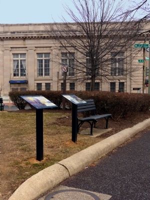
Location. 38° 53.243′ N, 77° 0.135′ W. Marker is in Southeast Washington in Washington, District of Columbia. It is in Capitol Hill. Marker is on Pennsylvania Avenue Southeast west of 3rd Street, on the right when traveling west. Touch for map. Marker is at or near this postal address: 200 3rd Street Southeast, Washington DC 20003, United States of America. Touch for directions.
Other nearby markers. At least 8 other markers are within walking distance of this marker. Destroying the Library (here, next to this marker); St. Mark's Church (about 400 feet away, measured in a direct line); Capitol Hill Presbyterian Church (about 400 feet away); American Legion Post 8 (approx. 0.2 miles away); Florida House (approx. 0.2 miles away); Little Ebenezer (approx.
¼ mile away); Original Site Of Providence Hospital (approx. ¼ mile away); Seventy Fifth Anniversary (approx. ¼ mile away). Touch for a list and map of all markers in Southeast Washington.
Credits. This page was last revised on November 4, 2023. It was originally submitted on February 15, 2015, by Allen C. Browne of Silver Spring, Maryland. This page has been viewed 517 times since then and 12 times this year. Photos: 1, 2. submitted on February 15, 2015, by Allen C. Browne of Silver Spring, Maryland. • Bill Pfingsten was the editor who published this page.

