Harleyville in Dorchester County, South Carolina — The American South (South Atlantic)
Harleyville
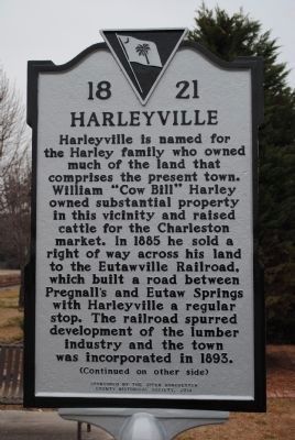
Harleyville is named for the Harley family who owned much of the land that comprises the present town. William "Cow Bill" Harley owned substantial property in this vicinity and raised cattle for the Charleston market. In 1885 he sold a right of way across his land to the Eutawville Railroad, which built a road between Pregnall,s and Eutaw Springs with Harleyville a regular stop. The railroad spurred development of the lumber industry and the town was incorporated in 1893.
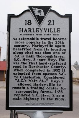
As automobile travel became more popular in the 20th century, Harleyville again benefited from its location along what was then one of S.C.'s main thoroughfares. S.C. Hwy. 2 (now Hwy. 178) was the first hard-surfaced road in Dorchester County. When completed in 1932 it extended from upstate S.C. to Charleston. Considered "S.C.'s Main St.," Hwy. 2 allowed Harleyville to remain a trading center for surrounding farms. I-26 replaced S.C. Hwy. 2 as a main highway in the 1960s.
Erected 2014 by The Upper Dorchester County Historical Society. (Marker Number 1821.)
Topics. This historical marker is listed in these topic lists: Roads & Vehicles • Settlements & Settlers. A significant historical year for this entry is 1885.
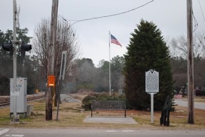
Location. 33° 12.873′ N, 80° 26.87′ W. Marker is in Harleyville, South Carolina, in Dorchester County. Marker is at the intersection of Main Street (U.S. 178) and North Railroad Avenue, on the left when traveling east on Main Street. Marker is located east of the railroad tracks. Touch for map. Marker is in this post office area: Harleyville SC 29448, United States of America. Touch for directions.
Other nearby markers. At least 8 other markers are within 8 miles of this marker, measured as the crow flies. St. Paul Camp Ground (approx. 2.1 miles away); Dorchester (approx. 6 miles away); Berkeley County (approx. 7 miles away); Spring Hill Methodist Church (approx. 7.2 miles away); Four Holes Swamp Bridge / Harley's Tavern (approx. 7.4 miles away); Four Holes Swamp (approx. 7.4 miles away); Revolutionary War Cannon (approx. 7.4 miles away); Moorefield Memorial Highway, (Southern Terminus) (approx. 7˝ miles away).
Credits. This page was last revised on October 12, 2021. It was originally submitted on February 18, 2015, by Dean Moss McCracken of Lakeland, Florida. This page has been viewed 987 times since then and 106 times this year. Photos: 1, 2, 3, 4. submitted on February 18, 2015, by Dean Moss McCracken of Lakeland, Florida. • Bernard Fisher was the editor who published this page.


