War on the Water
Star-Spangled National Historic Trail
| — | War of 1812 | — |
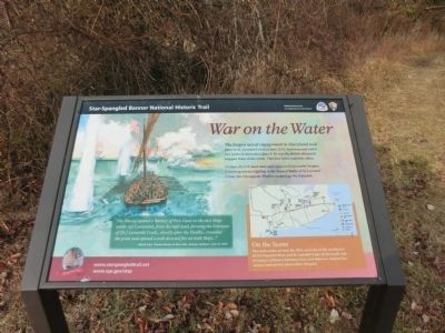
On June 26, U.S. land units gave support from nearby heights. Following the intense fighting in the Second Battle of St. Leonard Creek, the Chesapeake Flotilla escaped up the Patuxent.
“The Enemy opened a Battery of Five Guns on the two Ships under by Command, from the high land, forming the Entrance of (St.) Leonards Creek…shortly after the Flotilla…rounded the point and opened a well directed fire on both Ships…”
British Capt. Thomas Brown to Rear Adm. George Cockburn, June 27, 1814.
On the Scene
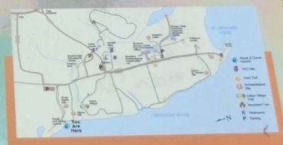
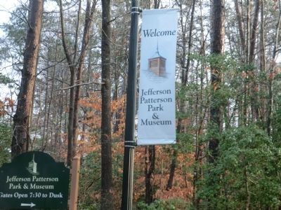
The main action of June 26, 1814, occurred at the confluence of the Patuxent River and St. Leonard Creek at the south end of today’s Jefferson Patterson Park and Museum. Explore the various interpretive sites within the park.
Erected by National Park Service-United States Department of the Interior.
Topics and series. This historical marker is listed in this topic list: War of 1812.
this page online
Location. 38° 24.125′ N, 76° 30.818′ W. Marker is in St. Leonard, Maryland, in Calvert County. It is on Jefferson Patterson Park Road. The marker is located on the grounds of Jefferson Patterson Park and Museum. Touch for map. Marker is in this post office area: Saint Leonard MD 20685, United States of America. Touch for directions.

Regionally, this marker is in Southern Maryland. It is also in the American South, specifically in the Upper South, in the Mid-Atlantic, in the Tidewater, in the Chesapeake Bay Region, and on the Eastern Seaboard. Globally, it is in the North Atlantic Region, North America, the Western Hemisphere, the Western World, and the Anglosphere. Historically, it finds itself in what was once one of the original Thirteen Colonies and also the Antebellum South.
Other nearby markers. At least 8 other markers are within walking distance of this marker: Indian Life at the Stearns Site (about 400 feet away, measured in a direct line); Evidence Found in the Ground (about
Credits. This page was last revised on June 16, 2016. It was originally submitted on February 18, 2015, by Don Morfe of Baltimore, Maryland. This page has been viewed 522 times since then and 30 times this year. Photos: 1, 2, 3, 4, 5. submitted on February 18, 2015, by Don Morfe of Baltimore, Maryland. • Bill Pfingsten was the editor who published this page.
