Near Corinne in Box Elder County, Utah — The American Mountains (Southwest)
The “Orange Special” Wreck
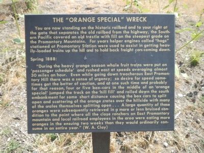
Photographed by Barry Swackhamer, August 27, 2014
1. The “Orange Special” Wreck Marker
Spring 1888:
“During the heavy orange season whole fruit trains were put on ‘passenger schedule' and rushed east at speeds averaging almost 30 miles an hour Even while going down treacherous East Promontory Hill there was a sense of urgency; so desire for speed sometimes got the better of caution, and at one such time and probably for that reason, four or five box-cars in the middle of an ‘orange special’ jumped the track on the ‘hill fill’ and rolled down the south embankment for some short distance causing the box cars to split open and scattering of the orange crates over the hillside with many of the crates themselves splitting open… A large quantity of these oranges were subsequently retrieved
this page online
Erected by National Park Service, U.S. Department of the Interior.
Topics. This historical marker is listed in these topic lists: Disasters • Railroads & Streetcars. A significant historical year for this entry is 1888.
Location. 41° 38.231′ N, 112° 29.407′ W. Marker is near Corinne, Utah, in Box Elder County. It can be reached from West Golden Spike Drive North, on the right when traveling west. Touch for map. Marker is in this post office area: Corinne UT 84307, United States of America. Touch for directions.

Regionally, this marker is in the Cache Valley and in the West Desert. It is also in the American Mountain West and on the Colorado Plateau. Globally, it is in North America, the Rocky Mountains, the Western Hemisphere, the Western World, and the Anglosphere. Historically, it finds itself in what was once New Spain and also Mexico’s Alta
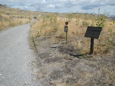
Photographed by Barry Swackhamer, August 27, 2014
2. The “Orange Special” Wreck Marker
Other nearby markers. At least 8 other markers are within 4 miles of this marker, measured as the crow flies: A different marker also named Big Fill Trail (about 400 feet away); The Big Trestle (approx. 0.6 miles away); The Big Fill (approx. 0.6 miles away); Chinese Arch (approx. 0.6 miles away); The Track that United the States (approx. 0.8 miles away); The Last Cut (approx. one mile away); Irish Monument (approx. 3.4 miles away); Original Rail (approx. 3.4 miles away). Touch for a list and map of all markers in Corinne.
Another marker is no longer nearby. Big Fill Trail (was about 300 feet away, measured in a direct line but has been permanently removed).
More about this marker. This marker is in Golden Spike National Historic Site and is located on the Big Fill Trail, stop 1, where it intersects the old Central Pacific railbed.
Credits. This page was last revised on June 16, 2016. It was originally submitted on February 21, 2015, by Barry Swackhamer of Brentwood, California. This page has been viewed 979 times since then and 34 times this year. Photos: 1, 2. submitted on February 21, 2015, by Barry Swackhamer of Brentwood, California. • Andrew Ruppenstein was the editor who published this page.
