Long Beach in Harrison County, Mississippi — The American South (East South Central)
Boggsdale
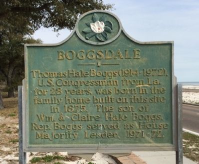
Photographed by Mark Hilton, February 19, 2015
1. Boggsdale Marker
Erected by the State of Mississippi.
Topics. This historical marker is listed in this topic list: Government & Politics. A significant historical year for this entry is 1875.
Location. 30° 20.291′ N, 89° 10.154′ W. Marker is in Long Beach, Mississippi, in Harrison County. It is at the intersection of Beach Boulevard West (U.S. 90) and Boggs Drive, on the right when traveling west on Beach Boulevard West. Touch for map. Marker is at or near this postal address: Beach Boulevard West, Long Beach MS 39560, United States of America. Touch for directions.

Regionally, this marker is in the American South, specifically in the Deep South, and on the Gulf Coast. Globally, it is in North America, a Gulf of Mexico state, the Western Hemisphere, the Western World, and the Anglosphere. Historically, it finds itself in what was once New Spain, the Viceroyalty of New France, the territory of the Mississippian
this page online
Other nearby markers. At least 8 other markers are within 2 miles of this marker, measured as the crow flies: Mt. Pilgrim Missionary Baptist Church (approx. 0.6 miles away); United Methodist Church (approx. 1.2 miles away); War Memorial Park (approx. 1.2 miles away); Long Beach World War II Monument (approx. 1.2 miles away); First Baptist Church Original Site (approx. 1.3 miles away); Early Bank and Post Office (approx. 1.3 miles away); Hurricane Katrina / Storm Recovery (approx. 1.4 miles away); Long Beach Schools (approx. 1.4 miles away). Touch for a list and map of all markers in Long Beach.
Also see . . . Family Profiles. (Submitted on February 23, 2015, by Mark Hilton of Montgomery, Alabama.)
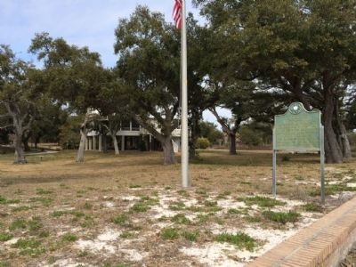
Photographed by Mark Hilton, February 19, 2015
2. Boggsdale Marker area along Boggs Drive
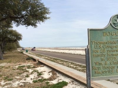
Photographed by Mark Hilton, February 19, 2015
3. View of marker looking east on U.S. 90
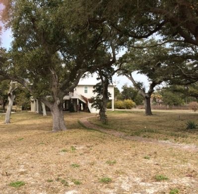
Photographed by Mark Hilton, February 19, 2015
4. Current home behind marker.
Credits. This page was last revised on June 16, 2016. It was originally submitted on February 23, 2015, by Mark Hilton of Montgomery, Alabama. This page has been viewed 1,510 times since then and 97 times this year. Photos: 1, 2, 3, 4. submitted on February 23, 2015, by Mark Hilton of Montgomery, Alabama.
