“We Must Have Done Them Considerable Damage”
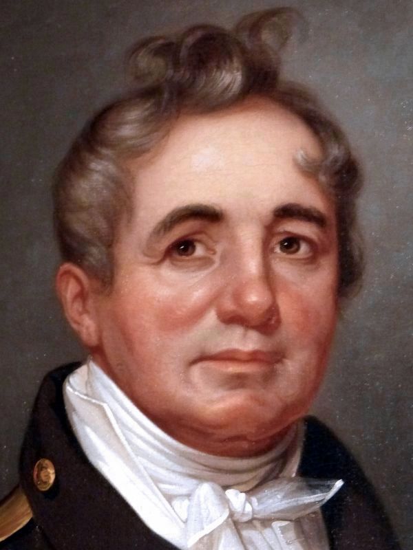
Captain Joshua Barney June 11, 1814
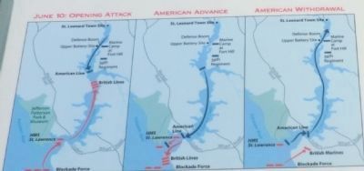
| — | First Battle of St. Leonard Creek | — |
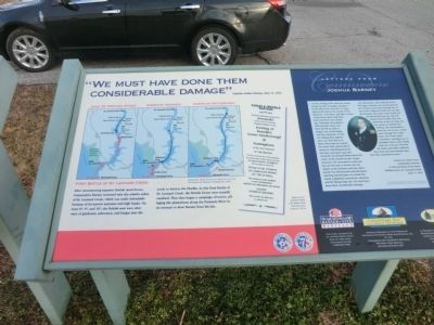
(Inscription next to the image in the center)
Replica of report from the Maryland Republican, June 4, 1814.
Letter from Commodore Joshua Barney
“…on the evening of the ninth the enemy moved up with 20 barges, having received more force from the 74 (gun ship-of-the-line) at the mouth of the Patuxent. I met them, and after a short action drove them until dark, and returned to my anchorage. Yesterday they made a bold attempt, about 2 pm they moved up with 21 barges, one rocket barge, and two schooners in tow. On making their appearance, we went down on them; they kept up a smart
this page online
…By information, they suffered much. The large schooner was nearly destroyed, having several shot through her at the water’s edge; her deck torn up, gun dismounted, and main-mast nearly cut off about half-way up, and rendered unserviceable. She was otherwise much cut; they ran her ashore to prevent her sinking. The commodore’s boat was cut in two; a shot went through the rocket boat; one of the small schooners, carrying two 32 pounders, had a shot which raked her from aft, forward; the boats, generally, suffered; but I have not ascertained what loss they sustained in men.” Extract of a letter from Commodore Barney to the Secretary of the Navy, William Jones, St. Leonard Creek, June 11, 1814.
Erected by Maryland Department of Housing and Community Development.
Topics. This memorial is listed in this topic list: War of 1812.
Location. 38° 23.661′ N, 76° 30.441′ W. Memorial is in St. Leonard, Maryland, in Calvert County. It is on Jefferson Patterson Park Road. The marker is on the grounds of the Jefferson Patterson Park and Museum. Touch for map. Memorial is in this post office area: Saint Leonard MD 20685, United States of America. Touch for directions.

Regionally, this memorial is in Southern Maryland. It is also in the American South, specifically in the Upper South, in the Mid-Atlantic, in the Tidewater, in the Chesapeake Bay Region, and on the Eastern Seaboard. Globally, it is in the North Atlantic Region, North America, the Western Hemisphere, the Western World, and the Anglosphere. Historically, it finds itself in what was once one of the original
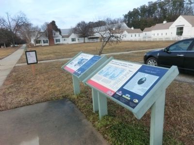
Other nearby markers. At least 8 other markers are within walking distance of this marker: The Search for the Chesapeake Flotilla (here, next to this marker); Smith’s St. Leonard Site (within shouting distance of this marker); Attention to Detail-Gertrude Sawyer, Architect (within shouting distance of this marker); The Government at St. Leonard’s (within shouting distance of this marker); John Stuart Skinner (within shouting distance of this marker); Valor at St. Leonard Creek (within shouting distance of this marker); “The Commodore Can Beat Any…Barges…Sent Against Him” (within shouting distance of this marker); Land Battle Evidence (within shouting distance of this marker). Touch for a list and map of all markers in St. Leonard.
Credits. This page was last revised on December 20, 2016. It was originally submitted on February 23, 2015, by Don Morfe of Baltimore, Maryland. This page has been viewed 634 times since then and 26 times this year. Photos: 1, 2, 3, 4. submitted on February 23, 2015, by Don Morfe of Baltimore, Maryland. 5. submitted on December 18, 2016, by Allen C. Browne of Silver Spring, Maryland. • Bill Pfingsten was the editor who published this page.
