Perils along the Patuxent
Star-Spangled Banner National Historic Trail
| — | War of 1812 | — |
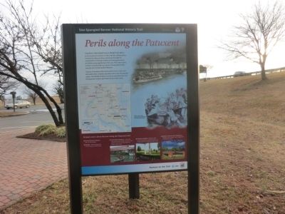
Citizens of Southern Maryland suffered more raids and skirmishes than residents anywhere else in the Chesapeake region. The British invaders moved up and down the river leaving panic, horror, and destruction in their wake.
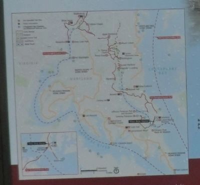
To learn more about the war along the Patuxent visit:
*Patuxent Naval Air Museum-War of 1812 exhibits
*Benedict-British landing site for the assault on Washington
*Calvert Marine Museum-Interactive map depicting the British invasion route; artifacts from the scuttled American flotilla, water access
*Scotterley Plantation-Restored 18th century plantation site for militia during the war.
*Jefferson Patterson Park and Museum-Exhibits, site of the largest naval engagement in Maryland history.
(Inscription on the image in the upper right)
Barney’s flotillamen
this page online
.
(Inscription next to the image in the lower right)
British raiders stole provisions and keepsakes from horrified residents.
Topics and series. This historical marker is listed in this topic list: War of 1812. In addition, it is included in the Star-Spangled Banner National Historic Trail series list. A significant historical year for this entry is 1814.
Location. 38° 19.893′ N, 76° 27.958′ W. Marker is in Solomons, Maryland, in Calvert County. It is on Solomons Island Road. The marker is on the grounds of the Solomons Island Visitor Center. Touch for map. Marker is in this post office area: Solomons MD 20688, United States of America. Touch for directions.
Regionally, this marker is in Southern Maryland. It is also in the American South, specifically in the Upper South, in the Mid-Atlantic, in the Tidewater, in the Chesapeake Bay Region, and on the Eastern Seaboard. Globally, it is in the North Atlantic Region, North America, the Western Hemisphere, the Western World, and the Anglosphere. Historically, it finds itself in what was once one of the original
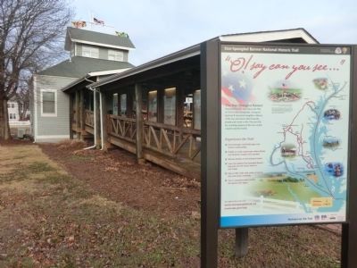
Other nearby markers. At least 8 other markers are within walking distance of this marker: Calvert County (within shouting distance of this marker); This Is A Sundial (within shouting distance of this marker); The Honor Tree (within shouting distance of this marker); Volunteer (about 400 feet away); Drum Point Lighthouse (about 500 feet away); Founders of the Calvert Marine Museum (about 500 feet away); War in the Chesapeake (about 500 feet away); "O! say can you see…" (about 500 feet away). Touch for a list and map of all markers in Solomons.
Other markers no longer nearby. Anchor (was within shouting distance of this marker but has been permanently removed); a different marker also named Anchor (was about 300 feet away, measured in a direct line but has been permanently removed).
Credits. This page was last revised on June 16, 2016. It was originally submitted on February 26, 2015, by Don Morfe of Baltimore, Maryland. This page has been viewed 607 times since then and 45 times this year. Photos: 1, 2, 3. submitted on February 26, 2015, by Don Morfe of Baltimore, Maryland. • Bill Pfingsten was the editor who published this page.
