Enemy Camp
Star-Spangled Banner National Historic Trail
| — | War of 1812 | — |
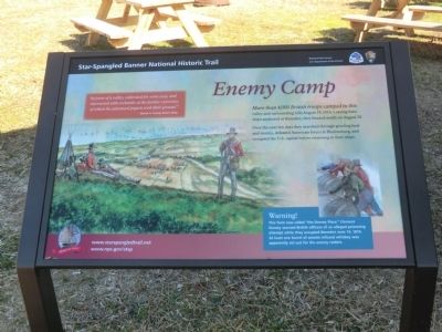
Over the next ten days they marched through grueling heat and storms, defeated American forces at Bladensburg, and occupied the U.S. capital before returning to their ships.
“In front of a valley, cultivated for some way, and intersected with orchards, at the further extremity of which the advanced piquets took their ground.”
British Lt. George Robert Gleig.
Warning!
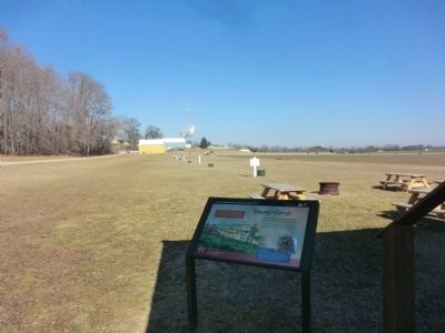
This farm was called “the Dorsey Place.” Clement Dorsey warned British officers of an alleged poisoning attempt while they occupied Benedict June 15, 1814. At least one barrel of arsenic-infused whiskey was apparently set out for the enemy raiders.
Erected by National Park Service-United States Department of the Interior.
Topics and series. This memorial is listed in this topic list: War of 1812. In addition, it is included in the Star-Spangled Banner National Historic Trail series list.
Location. 38° 31.066′ N, 76° 41.45′ W.
this page online

Regionally, this memorial is in the Washington Metropolitan Area and in Southern Maryland. It is also in the American South, specifically in the Upper South, in the Mid-Atlantic, in the Tidewater, and on the Eastern Seaboard. Globally, it is in the North Atlantic Region, North America, the Western Hemisphere, the Western World, and the Anglosphere. Historically, it finds itself in what was once one of the original Thirteen Colonies and also the Antebellum South.
Other nearby markers. At least 8 other markers are within 2 miles of this marker, measured as the crow flies: Camp Stanton (within shouting distance of this marker); On This Farm (within shouting distance of this marker); Solid Ground (approx. 0.2 miles away); a different marker also named Camp Stanton (approx. 0.6 miles away); Benedict (approx. 0.6 miles away); British Have Landed (approx. 0.9 miles away);
Another marker is no longer nearby. Camp Stanton (was approx. one mile away but has been confirmed missing).
Credits. This page was last revised on June 16, 2016. It was originally submitted on March 2, 2015, by Don Morfe of Baltimore, Maryland. This page has been viewed 1,027 times since then and 63 times this year. Photos: 1, 2, 3. submitted on March 2, 2015, by Don Morfe of Baltimore, Maryland. • Bill Pfingsten was the editor who published this page.
