Belmopan, Cayo, Belize — Central America
Founding of Belmopan
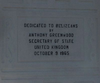
by
Anthony Greenwood
Secretary of State
United Kingdom
October 9 1965
Erected 1965.
Topics. This historical marker is listed in this topic list: Settlements & Settlers. A significant historical month for this entry is October 1861.
Location. 17° 16.351′ N, 88° 46.827′ W. Marker is in Belmopan, Cayo. Marker is on Western Highway (at milepost 49),, on the left when traveling east. Touch for map. Marker is in this post office area: Belmopan, Cayo 7L1GH KVBSL, Belize. Touch for directions.
Other nearby markers. At least 6 other markers are within 5 kilometers of this marker, measured as the crow flies. Olmec Colossal Head (approx. 2.2 kilometers away); Harriot W. Topsey (approx. 2.3 kilometers away); The Flag of Belize (approx. 2.6 kilometers away); Belize's 10th Anniversary of Independence (approx. 2.6 kilometers away); Agripino Cawich Bridge (approx. 3.5 kilometers away); Rt. Hon. George C. Price (approx. 3.5 kilometers away).
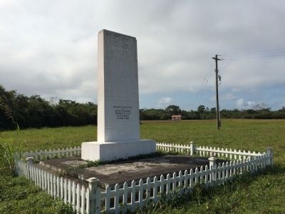
Regarding Founding of Belmopan. After Hurricane Hattie almost completely destroyed Belize City in 1961, a movement to change the location of the capital to higher ground inland began. George Price, as Premier of the colony of British Honduras, invited then Secretary of State for the Commonwealth and Colonies, Anthony Greenwood, to visit. During that visit on October 9, 1965 he visited the site of Belmopan, today's capital of Belize, and inaugurated this monument as a way to show UK commitment to its founding. The first phase of construction in Belmopan was completed in 1970.
Credits. This page was last revised on May 14, 2019. It was originally submitted on March 4, 2015, by J. Makali Bruton of Accra, Ghana. This page has been viewed 568 times since then and 9 times this year. Photos: 1, 2. submitted on March 4, 2015, by J. Makali Bruton of Accra, Ghana. • Andrew Ruppenstein was the editor who published this page.

