Charlotte Hall in St. Mary's County, Maryland — The American Northeast (Mid-Atlantic)
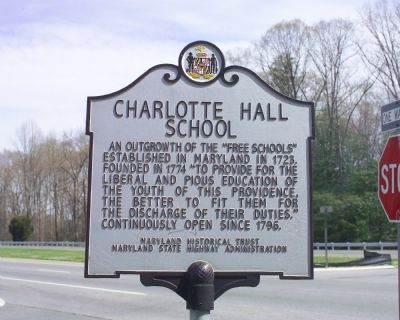
Charlotte Hall School
Erected by the Maryland Historic Trust and the Maryland State Highway Administration.
Topics. This historical marker is listed in these topic lists: Education • Military. A significant historical year for this entry is 1723.
Location. 38° 28.717′ N, 76° 46.533′ W. Marker is in Charlotte Hall, Maryland, in St. Mary's County. Marker is at the intersection of Three Notch Road (Maryland Route 5) and Charlotte Hall School Road, on the right when traveling south on Three Notch Road. It is at the St. Mary’s County Welcome Center. Touch for map. Marker is in this post office area: Charlotte Hall MD 20622, United States of America. Touch for directions.
Other nearby markers. At least 8 other markers are within walking distance of this marker. No Match for British Might (within shouting distance of this marker); Maryland Begins Here (within shouting distance of this marker); Coole Springs of Saint Marie’s (about 600 feet away, measured in a direct line); a different marker also named Charlotte Hall School (about 700 feet away); Cadet Pierre A. Mourthé (about 700 feet away); Ye Coole Springs (about 800 feet away); Village of Charlotte Hall (approx. ¼ mile away); Amish Community (approx. 0.3 miles away). Touch for a list and map of all markers in Charlotte Hall.
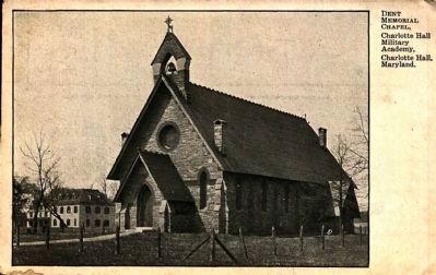
Regarding Charlotte Hall School. Also known as the Charlotte Hall Military Academy, the school closed in 1976, long after this marker was erected. It is now the Charlotte Hall Veterans’ Home. The Veterans’ Home provides assisted living and long-term care for Maryland’s veterans.
Also see . . . Charlotte Hall Veterans Home. (Submitted on April 8, 2007.)
Photographed By Tom Fuchs, March 31, 2007
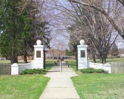
2. Charlotte Hall School Main Gate
This gate is on Charlotte Hall Road, which parallels Route 5 one block east. It was the main road through town before the Route 5 bypass was built. Directly across the road is Coole Springs. The plaque on the left repeats this marker’s text, adding “Closed 1976.” The plaque on the right is the Cadet Pierre A. Mourthé Marker.
Photographed By Tom Fuchs, March 31, 2007
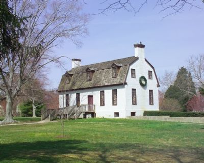
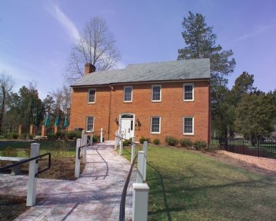
4. Major Burgee House
Now the St. Mary’s County Welcome Center, this house was originally built and named for Major Burgee, who became headmaster in 1938. It is staffed weekends year-round and every day in the summer. Stop in to pick up brochures and learn more about Southern Maryland’s tourist and historical attractions.
Credits. This page was last revised on March 30, 2018. It was originally submitted on April 8, 2007, by Tom Fuchs of Greenbelt, Maryland. This page has been viewed 7,145 times since then and 177 times this year. Last updated on March 8, 2015, by J. Makali Bruton of Accra, Ghana. Photos: 1, 2, 3, 4, 5. submitted on April 8, 2007, by Tom Fuchs of Greenbelt, Maryland. 6. submitted on March 7, 2015. • Syd Whittle was the editor who published this page.
