Blues Beach in Hampshire County, West Virginia — The American South (Appalachia)
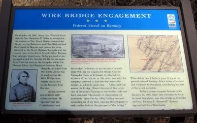
Wire Bridge Engagement
Federal Attack on Romney
Johns, however, encountered stiff resistance her. He reported that Confederates had entrenched “riflemen on an eminence immediately fronting the suspension bridge. Captain Alexander Shaw, of Company A, who led the advance of the column to this point, was with his company, directed to lead the way across the bridge, at a double quick step. … About half way across the bridge, [Shaw] discovered that a portion of the plank flooring on the further side had been removed. The enemy on discovering the movement, open fire by volley, killing one and wounding six of my men, causing the company to seek shelter behind the parapets of the bridge.”
When Johns heard Kelley’s guns firing as the general entered Romney, Johns broke off contact and withdrew to Maryland, considering his part of the attack complete.
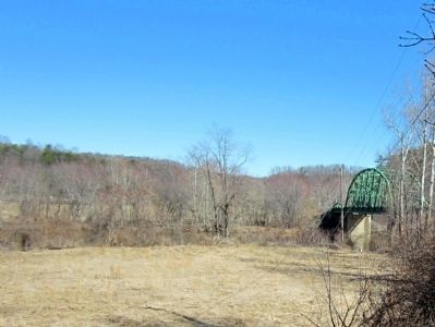
Kelley’s troops occupied Romney until January 10, 1862, when they retreated to Cumberland, Maryland, over this bridge as Confederate Gen. Thomas J. “Stonewall” Jackson approached from Winchester.
(captions)
(lower left) Gen. Benjamin F. Kelley Courtesy Library of Congress
(Top center) “Gen. Kelley’s troops crossing the long bridge, near Romney, on his retreat to Cumberland,” from New York Illustrated News, 1862 Courtesy Library of Congress
Erected by West Virginia Civil War Trails.
Topics and series. This historical marker is listed in this topic list: War, US Civil. In addition, it is included in the West Virginia Civil War Trails series list. A significant historical date for this entry is January 10, 2002.
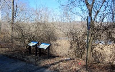
Location. 39° 25.567′ N, 78° 42.9′ W. Marker is in Blues Beach, West Virginia, in Hampshire County. Marker is at the intersection of Cumberland Road (West Virginia Route 28) and Long Road (County Route 28/4), on the left when traveling north on Cumberland Road. Located at the south end of the bridge over South Branch Potomac River. Touch for map. Marker is in this post office area: Springfield WV 26763, United States of America. Touch for directions.
Other nearby markers. At least 8 other markers are within 6 miles of this marker, measured as the crow flies. Mount Bethel Church (approx. 3.7 miles away); Fort Forman (approx. 3.7 miles away); The Guns Of Jacob Sheetz (approx. 4 miles away); Old District Parsonage (approx. 6 miles away); Fort Ashby (approx. 6.1 miles away); a different marker also named Fort Ashby (approx. 6.1 miles away); American Discovery Trail (approx. 6.1 miles away); a different marker also named Fort Ashby (approx. 6.1 miles away).
More about this marker. This interpretive panel was originally located across the road at approximately these map coordinates: 39° 25.552′ N, 78° 42.94′ W.
Additional commentary.
1. Marker has moved
I visited this site on 5/14/2023 and can report that the Wire Bridge Engagement Marker has moved to the east side of the road closer to the bridge in the vicinity of 39°25'34.5"N 78°42'54.3"W. The bridge itself was replaced in early 2022.
— Submitted May 25, 2023, by Michael Kleen of Woodbridge, Virginia.
Credits. This page was last revised on June 1, 2023. It was originally submitted on March 12, 2015, by Bernard Fisher of Richmond, Virginia. This page has been viewed 842 times since then and 31 times this year. Photos: 1, 2, 3. submitted on March 12, 2015, by Bernard Fisher of Richmond, Virginia.


