Marker Logo HMdb.org THE HISTORICAL
MARKER DATABASE
“Bite-Size Bits of Local, National, and Global History”
St. Albans in Kanawha County, West Virginia — The American South (Appalachia)
 

St. Albans Covered Bridge


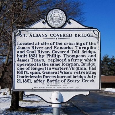
St. Albans Covered Bridge Marker image. Click for full size.
Photographed By Bernard Fisher, March 7, 2015
1. St. Albans Covered Bridge Marker
Inscription. Located at the site of the crossing of the James River and Kanawha Turnpike and Coal River. Covered Toll Bridge, built 1831 by Phillip Thompson and James Teays, replaced a ferry which operated in the same location. Bridge, one of the longest in western Virginia, had 180 ft. span. General Wise’s retreating Confederate forces burned bridge July 21, 1861, after Battle of Scary Creek.
St. Albans Historical Society: WV Celebration 2000

 
Erected 2003 by West Virginia Division of Archives and History.
 
Topics and series. This historical marker is listed in these topic lists: Bridges & ViaductsWar, US Civil. In addition, it is included in the Covered Bridges, and the West Virginia Archives and History series lists. A significant historical date for this entry is July 21, 1861.
 
Location. 38° 23.186′ N, 81° 50.38′ W. Marker is in St. Albans, West Virginia, in Kanawha County. Marker is at the intersection of 6th Avenue and West Main Street, on the right when traveling south on 6th Avenue. Touch for map. Marker is in this post office area: Saint Albans WV 25177, United States of America. Touch for directions.
 
Other nearby markers. At least 8 other markers are within 2 miles of this marker, measured as the crow flies. St. Mark's Episcopal Church (about 700 feet away, measured in a direct line); First Baptist Church (approx. 0.2 miles away); Old St. Albans Post Office
Paid Advertisement
Click on the ad for more information.
Please report objectionable advertising to the Editor.
Click or scan to see
this page online
(approx. 0.2 miles away); Washington's Land (approx. ¾ mile away); George Washington (approx. ¾ mile away); World War I Memorial (approx. 0.8 miles away); Fort Tackett (approx. 1.2 miles away); St. Albans Archeological Site (approx. 1.6 miles away). Touch for a list and map of all markers in St. Albans.
 
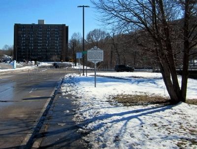
St. Albans Covered Bridge Marker (facing south) image. Click for full size.
Photographed By Bernard Fisher, March 7, 2015
2. St. Albans Covered Bridge Marker (facing south)
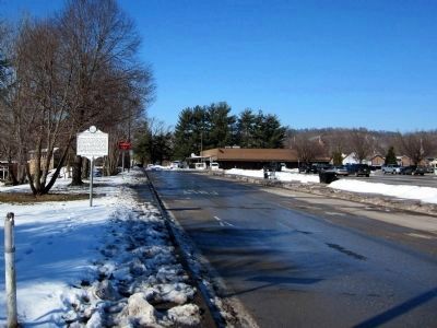
St. Albans Covered Bridge Marker (facing north) image. Click for full size.
Photographed By Bernard Fisher, March 7, 2015
3. St. Albans Covered Bridge Marker (facing north)
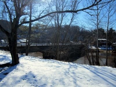
Modern bridge over the Coal River image. Click for full size.
Photographed By Bernard Fisher, March 7, 2015
4. Modern bridge over the Coal River
 
 
Credits. This page was last revised on June 16, 2016. It was originally submitted on March 13, 2015, by Bernard Fisher of Richmond, Virginia. This page has been viewed 556 times since then and 6 times this year. Photos:   1, 2, 3, 4. submitted on March 13, 2015, by Bernard Fisher of Richmond, Virginia.
Share this page.  
Share on Tumblr
m=81411

CeraNet Cloud Computing sponsors the Historical Marker Database.
This website earns income from purchases you make after using our links to Amazon.com. We appreciate your support.
Paid Advertisements
Mar. 19, 2024