Streeterville in Chicago in Cook County, Illinois — The American Midwest (Great Lakes)
Illinois & Michigan Canal
National Heritage Corridor
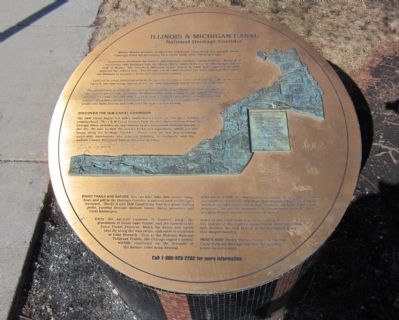
Water Marks mosaic sculptures celebrate something few people know. Chicago owes its greatness to a canal built over 150 years ago.
Generations of French fur traders and American travelers―nation builders―dreamed of connecting Lake Michigan with the Illinois River, which flows into the Mississippi and the Gulf of Mexico. The Illinois & Michigan Canal, begun in 1836 and completed in 1846, provided the critical link. The 97-mile I&M Canal became the water highway that opened the Midwest to commerce in the mid-nineteenth century.
Laid out by canal commissioners at the eastern end was a town called Chicago. When the canal opened, the tiny village sprouted into the most important city of the American Midwest.
The canal closed in 1933, but its legacy continues to shape Illinois. In 1984, recognizing the canals pivotal role, Congress designated the canal region as the I&M Canal National Heritage Corridor. The old I&M Canal is now a place to ride bikes, hike, and paddle canoes. Itís a place to reconnect with the beauty of prarie landscapes and small-town Main Streets and rediscover the regionís rich history.
Discover the I&M Canal Corridor
The I&M Canal began 5.5 miles southwest of here, in Chicagoís Bridgeport neighborhood. The I&M Canal Origins Park, located where the canal met the Chicago River, provides an opportunity to get acquainted with the history of the city. Be sure to visit the canalís locks and aqueducts, which are still found along the Heritage Corridor. Donít miss the last two surviving canal-side warehouses―the Gaylord Building, in Lockport, and the LaSalle County Historical Society Museum in Utica.
Enjoy Trails and Nature You can hike, bike, fish, picnic, camp, boat, and golf in the Heritage Corridor, a national park in Chicagoís backyard. The 61.5 mile I&M canal State Trail is a great starting point, passing through historic towns, forest preserves and rural landscapes.
Enjoy the ancient canyons of Starved Rock, the grasslands of Goose Lake Prairie, and the ravines of the Palos Forest Preserve. Watch for heron and egrets that fly along the waterways, and roost in rookeries at Lake Renwick. Stop at Midewin National Tallgrass Prairie, the Chicago regionís newest wildlife sanctuary on the grounds of the former Joliet Army Arsenal.
Step Back in Time The I&M Canal towns outside Chicago still show their nineteenth century charm. Visit Main Street shopping districts and enjoy a variety of specialty stores. See historic churches, city halls, homes and storefronts. Discover the unexpected―an ornate movie palace in Joliet, or a grain elevator turned visitor center in Seneca.
Learn of the coral reefs that once covered the area. Trace the history of the regionís many Native American tribes and discover the rich history of the immigrant groups that shaped America.
Hereís How Twelve Visitor Centers in the I&M Canal National Heritage Corridor are starting points for excursions.
Call 1-800-926-2262 for more information.
Topics. This historical marker is listed in these topic lists: Industry & Commerce • Settlements & Settlers • Waterways & Vessels. A significant historical year for this entry is 1836.
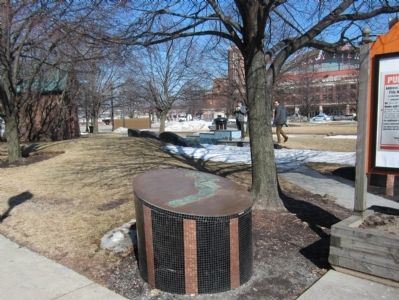
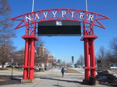
Location. 41° 53.474′ N, 87° 36.661′ W. Marker is in Chicago, Illinois, in Cook County. It is in Streeterville. Marker is at the intersection of North Streeter Drive and East Illinois Street, on the left when traveling south on North Streeter Drive. Located at the entrance to Navy Pier. Touch for map. Marker is in this post office area: Chicago IL 60611, United States of America. Touch for directions.
Other nearby markers. At least 8 other markers are within walking distance of this marker. Milton L. Olive III Park (approx. ľ mile away); Monument of the Millennium (approx. ľ mile away); The Honorable Joanne H. Alter (approx. 0.4 miles away); Q.S.M.V. Abegweit (approx. half a mile away); Columbia Yacht Club (approx. half a mile away); Shelter Building (approx. half a mile away); Terminal Building (approx. half a mile away); Navy Pier Salute (approx. 0.6 miles away). Touch for a list and map of all markers in Chicago.
Credits. This page was last revised on January 30, 2023. It was originally submitted on March 13, 2015, by Bernard Fisher of Richmond, Virginia. This page has been viewed 566 times since then and 15 times this year. Photos: 1, 2, 3. submitted on March 13, 2015, by Bernard Fisher of Richmond, Virginia.


