Meridian Hills/Williams Creek in Indianapolis in Marion County, Indiana — The American Midwest (Great Lakes)
Indiana School for the Blind
Photographed by Bernard Fisher, March 8, 2015
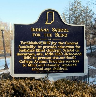
1. Indiana School for the Blind Marker
Established 1847 by the General Assembly to provide education for Indiana's blind children. School on downtown site, 1848-1930. Relocated 1930 to present site on North College Avenue. Provides services to blind and visually impaired school-age children.
Erected 1994 by Indiana Historical Bureau. (Marker Number 49.1994.1.)
Topics and series. This historical marker is listed in this topic list: Education. In addition, it is included in the Indiana Historical Bureau Markers series list. A significant historical year for this entry is 1847.
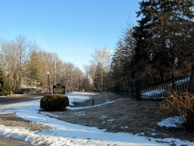
Location. 39° 53.725′ N, 86° 8.737′ W. Marker is in Indianapolis, Indiana, in Marion County. It is in Meridian Hills/Williams Creek. It is on North College Avenue 0.4 miles north of East 75th Street, on the right when traveling north. Touch for map. Marker is at or near this postal address: 7725 North College Avenue, Indianapolis IN 46240, United States of America. Touch for directions.

Regionally, this marker is in Central Indiana. It is also in the American Midwest and in the Corn Belt. Globally, it is in North America, the Western Hemisphere, the Western World, and the Anglosphere.
this page online
Other nearby markers. At least 8 other markers are within 4 miles of this marker, measured as the crow flies: Town of Meridian Hills (approx. ¾ mile away); a different marker also named Town of Meridian Hills (approx. 1.7 miles away); North Meridian Street Historic District (approx. 2.7 miles away); The Central Canal (approx. 2.9 miles away); Founders Green (approx. 3.2 miles away); Pleasant Grove Cemetery (approx. 3.2 miles away); Hinkle Fieldhouse (approx. 3.8 miles away); Central Canal & Towpath (approx. 3.9 miles away). Touch for a list and map of all markers in Indianapolis.
Also see . . . Indiana School for the Blind & Visually Impaired. Indiana State website entry (Submitted on March 13, 2015.)
Photographed by Bernard Fisher, March 8, 2015
2. Indiana School for the Blind Marker
Photographed by Bernard Fisher, March 8, 2015
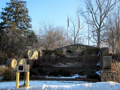
3. Indiana School for the Blind
Credits. This page was last revised on October 7, 2024. It was originally submitted on March 13, 2015, by Bernard Fisher of Richmond, Virginia. This page has been viewed 710 times since then and 38 times this year. Photos: 1, 2, 3. submitted on March 13, 2015, by Bernard Fisher of Richmond, Virginia.
