Woodruff Place in Indianapolis in Marion County, Indiana — The American Midwest (Great Lakes)
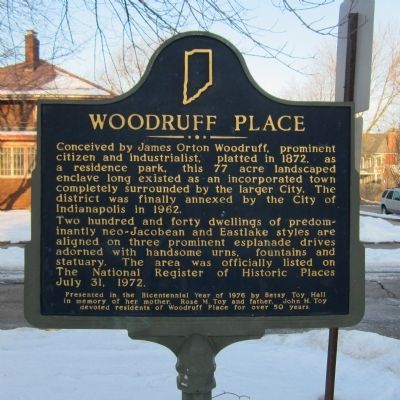
Woodruff Place
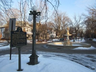
Two hundred and forty dwellings of predominantly neo-Jacobean and Eastlake styles are aligned on three prominent esplanade drives adorned with handsome urns, fountains and statuary. The area was officially listed on The National Register of Historic Places July 31, 1972.
Erected 1976 by Betsy Toy Hall. (Marker Number 49.1976.3.)
Topics and series. This historical marker is listed in this topic list: Settlements & Settlers. In addition, it is included in the Indiana Historical Bureau Markers series list. A significant historical date for this entry is July 31, 1896.
Location. 39° 46.662′ N, 86° 7.708′ W. Marker is in Indianapolis, Indiana, in Marion County. It is in Woodruff Place. Marker is at the intersection of Woodruff Place Middle Drive and Woodruff Place Cross Drive, in the median on Woodruff Place Middle Drive. Touch for map. Marker is in this post office area: Indianapolis IN 46201, United States of America. Touch for directions.
Other nearby markers. At least 8 other markers are within one mile of this marker, measured as the crow flies. Former U.S. Arsenal (approx. 0.3 miles away); Indianapolis Public Library Branch No. 6 (approx. half a mile away); Willard Park (approx. 0.7 miles away); John Hope School No. 26 (approx. 0.9 miles away); Indianapolis Public Library Branch No. 3 (approx. 0.9 miles away); North Western Christian University (approx. one mile away); Crossing of the National and Michigan Roads (approx. one mile away); St. Vincent’s Infirmary (approx. 1.1 miles away). Touch for a list and map of all markers in Indianapolis.
Credits. This page was last revised on February 4, 2023. It was originally submitted on March 13, 2015, by Bernard Fisher of Richmond, Virginia. This page has been viewed 462 times since then and 14 times this year. Photos: 1, 2. submitted on March 13, 2015, by Bernard Fisher of Richmond, Virginia.

