Old Port in Québec in Communauté-Urbaine-de-Québec, — Central Canada (French-Canadian)
The Siege of Québec, 1775 - 1776
Le siège de Québec, 1775 - 1776
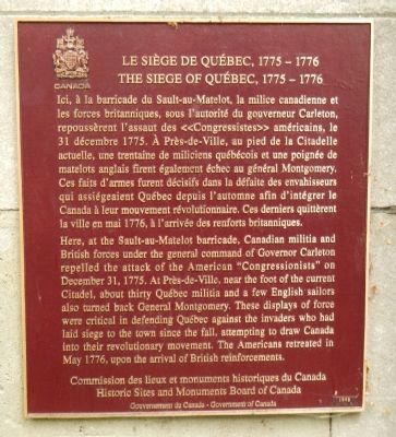
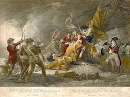
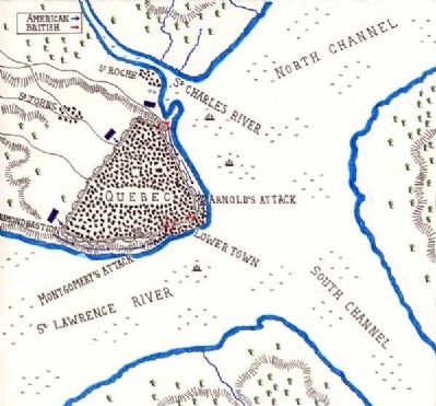
Here, at the Sault-au-Matelot barricade, Canadian militia and British forces under the general command of Governor Carleton repelled the attack of the American "Congressionists" on December 31, 1775. At Près-de-Ville, near the foot of the current Citadel, about thirty Québec militia and a few English sailors also turned back General Montgomery. These displays of force were critical in defending Québec against the invaders who had laid siege to the town since the fall, attempting to draw Canada into their revolutionary movement. The Americans retreated in May 1776, upon the arrival of British reinforcements.
French:
Ici, à la barricade du Sault-au-Matelot, la milice canadienne et les forces britanniques, sous l'autorité du gouverneur Carleton, repoussèrent l'assaut des «Congressistes» américains, le 31 décembre 1775. À Près-de-Ville, au pied de la Citadelle actuelle, une trentaine de miliciens québécois et une poignée de matelots anglais firent également échec au général Montgomery. Ces faits d'armes furent décisifs dans la défaite des envahisseurs qui assiégeaient Québec depuis l'automne afin d'intégrer le Canada à leur mouvement révolutionnaire. Ces derniers quittèrent la ville en mai 1776, à l'arrivée des renforts britanniques.
Erected 1998 by Historic Sites and Monument Board of Canada/Commission de lieux et monuments historique du Canada.
Topics and series. This historical marker is listed in this topic list: War, US Revolutionary. In addition, it is included in the Canada, Historic Sites and Monuments Board series list. A significant historical date for this entry is December 31, 1775.
Location. 46° 48.932′ N, 71° 12.214′ W. Marker is in Québec, in Communauté-Urbaine-de-Québec. It is in Old Port. Marker is on Rue de la Barricade close to Rue Saint-PIerre, on the left when traveling east. Touch for map. Marker is at or near this postal address: 43 Rue de la Barricade, Québec G1K 4A6, Canada. Touch for directions.
Other nearby markers. At least 8 other markers are within walking distance of this marker. Guy Carleton (a few steps from this marker); Premier local de la Banque de Montréal à Québec (within shouting distance of this marker); Place de la FAO (within shouting distance of this marker); Hommage à Lester B. Pearson / Homage to Lester B. Pearson (within shouting distance of this marker); Jean Baillairgé (about 120 meters away, measured in a direct line); Les Premiers Colons de Québec (about 150 meters away); Charles Aubert de la Chesnaye (about 180 meters away); Urselines de Quebec (about 180 meters away). Touch for a list and map of all markers in Québec.
Also see . . .
1. The Battle of Quebec - The American Revolution. org. The Battle of Quebec was an attempt on December 31, 1775, by American colonial forces to capture the city of Quebec, drive the British military from the Province of Quebec, and enlist French Canadian support for the American Revolutionary War. The British governor of Quebec, General Guy Carleton, could not get significant outside help because the St. Lawrence River was frozen, so he had to rely on a relatively small number of regulars along with local militia that had been raised in the city. (Submitted on March 14, 2015, by Barry Swackhamer of Brentwood, California.)
2. Battle of Quebec (1775) - Wikipedia. This was the first defeat suffered by the Continental Army. Carleton reported 30 Americans killed and 431 taken prisoner, including about two-thirds of Arnold's force. He also wrote that "many perished on the River" attempting to get away. Allan Maclean reported that 20 bodies were recovered in the spring thaw the following May. Arnold reported about 400 missing or captured, and his official report to Congress claimed 60 killed and 300 captured. British casualties were comparatively light. Carleton's initial report to General William Howe mentioned only five killed or wounded, but other witness reports ranged as high as 50. Carleton's official report listed five killed and 14 wounded. (Submitted on March 14, 2015, by Barry Swackhamer of Brentwood, California.)
Credits. This page was last revised on February 9, 2023. It was originally submitted on March 14, 2015, by Barry Swackhamer of Brentwood, California. This page has been viewed 729 times since then and 44 times this year. Photos: 1, 2, 3, 4. submitted on March 14, 2015, by Barry Swackhamer of Brentwood, California. • Andrew Ruppenstein was the editor who published this page.


