
Estill Springs in Franklin County, Tennessee — The American South (East South Central)
Camp Harris
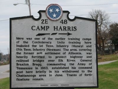
Photographed by Tom Gillard, November 18, 2009
1. Camp Harris Marker
Erected by Tennessee Historical Commission. (Marker Number 2E 48.)
Topics and series. This historical marker is listed in this topic list: Notable Places. In addition, it is included in the Tennessee Historical Commission series list. A significant historical year for this entry is 1863.
Location. 35° 15.251′ N, 86° 7.254′ W. Marker is in Estill Springs, Tennessee, in Franklin County. It is on South Main Street (Tennessee Route 41-a), on the right when traveling north. Touch for map. Marker is in this post office area: Estill Springs TN 37330, United States of America. Touch for directions.

Regionally, this marker is in Middle Tennessee
this page online
Other nearby markers. At least 8 other markers are within 5 miles of this marker, measured as the crow flies: Carrick Academy (approx. 4½ miles away); Bridge Construction / Franklin County Old Jail Museum (approx. 4.6 miles away); Bates Foods / Franklin County Library (approx. 4.6 miles away); Built 1938 (approx. 4.7 miles away); Built 1919 (approx. 4.7 miles away); Built 1930 (approx. 4.7 miles away); Mike Farris (approx. 4.7 miles away); Built 1894 (approx. 4.7 miles away).
Other markers no longer nearby. Tullahoma Campaign (was approx. 4.6 miles away but has been permanently removed); a different marker also named Tullahoma Campaign (was approx. 4.6 miles away but has been permanently removed).
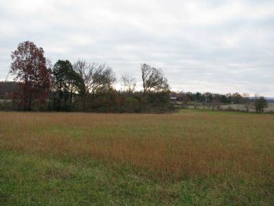
Photographed by Tom Gillard, November 18, 2009
2. Field around Camp Harris Marker
Credits. This page was last revised on June 16, 2016. It was originally submitted on November 18, 2009, by Tom Gillard of Tullahoma, Tennessee. This page has been viewed 3,387 times since then and 147 times this year. Last updated on March 15, 2015, by J. Makali Bruton of Washington, District of Columbia. Photos: 1, 2. submitted on November 18, 2009, by Tom Gillard of Tullahoma, Tennessee. • Bill Pfingsten was the editor who published this page.
