Foley in Baldwin County, Alabama — The American South (East South Central)
Cobb's Light
Photographed by David J Gaines, January 14, 2012
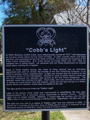
1. Cobb's Light Marker
Early in Chief Cobb’s tenure, the Town of Foley entered into an innovative agreement with John M. Snook, the founder of the Gulf Telephone Company, in an effort to quicken police response time. A light was erected atop the building on the southwest corner of this intersection. Citizens in need of police service would call the Gulf Telephone Co. operator who served as the first Police Dispatcher. The operator would then activate the light. Chief Cobb, who was normally on foot patrol or sitting on a park bench near this location, would see the light and go to the nearby phone where the operator would relay the details of the call.
The light quickly became known as “Cobb’s
this page online
The light you see is a replica of “Cobb’s Light” and was replaced in 2008. It serves as a reminder of the early days of Police service and as a memorial to the dedicated service of Chief B.D. Cobb, the first of “Foley’s Finest”.
Topics. This historical marker is listed in this topic list: Charity & Public Work. A significant historical year for this entry is 1942.
Location. 30° 24.411′ N, 87° 41.019′ W. Marker is in Foley, Alabama, in Baldwin County. It is on Alabama Route 59, on the left when traveling south. The marker is located in a park at the intersection of AL Hwy 59 and US Hwy 98. Touch for map. Marker is in this post office area: Foley AL 36536, United States of America. Touch for directions.

Regionally, this marker is on the Gulf Coast and in the Mobile
Photographed by David J Gaines, January 14, 2012
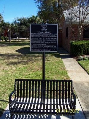
2. Cobb's Light Marker
Other nearby markers. At least 8 other markers are within 8 miles of this marker, measured as the crow flies: City of Foley Camellia Walk (within shouting distance of this marker); City of Foley (about 300 feet away, measured in a direct line); Summerdale / Summerdale's Turpentine Still (approx. 4.7 miles away); The Springs (approx. 5.1 miles away); Magnolia Springs, Alabama (approx. 5.2 miles away); Sonora Community / Sonora School and Community Hall (approx. 5.6 miles away); The Charles Swift Family / Swift Coles Historic Home (approx. 7.1 miles away); Vicinity of Salt Works and Camp Anderson (approx. 8 miles away). Touch for a list and map of all markers in Foley.
Credits. This page was last revised on June 16, 2016. It was originally submitted on February 4, 2012, by David J Gaines of Pinson, Alabama. This page has been viewed 5,671 times since then and 326 times this year. Last updated on March 16, 2015, by J. Makali Bruton of Washington, District of Columbia. Photos: 1, 2. submitted on February 4, 2012, by David J Gaines of Pinson, Alabama. • Bill Pfingsten was the editor who published this page.
