St. Marys in Camden County, Georgia — The American South (South Atlantic)
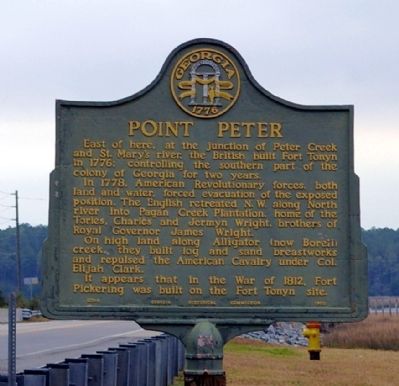
Point Peter
In 1778, American Revolutionary forces, both land and water, forced evacuation of the exposed position. The English retreated N.W. along North river into Pagan Creek Plantation, home of the Tories, Charles and Jermyn Wright, brothers of Royal Governor James Wright.
On high land along Alligator (now Borell) creek, they built log and sand breastworks and repulsed the American Cavalry under Col. Elijah Clark.
It appears that in the War of 1812, Fort Pickering was built on the Fort Tonyn site.
Erected 1953 by Georgia Historical Commission. (Marker Number 020-8.)
Topics and series. This historical marker is listed in these topic lists: Forts and Castles • War of 1812 • War, US Revolutionary. In addition, it is included in the Georgia Historical Society series list. A significant historical year for this entry is 1776.
Location. 30° 45.583′ N, 81° 31.467′ W. Marker is in St. Marys, Georgia, in Camden County. Marker is on North River Causeway, 0.1 miles west of New Point Peter Road, on the left when traveling east. Touch for map. Marker is in this post office area: Saint Marys GA 31558, United States of America. Touch for directions.
Other nearby markers. At least 8 other markers are within 3 miles of this marker, measured as the crow flies. Point Peter Battery and the War of 1812 (approx. half a mile away); Spanish Occupation of Georgia (approx. 2.7 miles away); City of St. Marys (approx. 2.7 miles away); St. Marys Methodist Church Established 1799-1800 (approx. 2.8 miles away); First Presbyterian Church (approx. 2.8 miles away); Washington Pump & Oak (approx. 2.8 miles away); George Washington Oak Tree Site (approx. 2.8 miles away); Clark-Bessant House (approx. 2.8 miles away). Touch for a list and map of all markers in St. Marys.
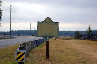
More about this marker. The marker was originally (1953) located at Osborne Road (US 40)and Point Peter Road. It was moved to this location in the past two years, losing its original monopole in the process (it's now mounted on a square wooden post).
Related markers. Click here for a list of markers that are related to this marker.
Also see . . . Point Peter and the St. Marys River Forts. LAMAR Institute Publication 62 (Submitted on December 27, 2008, by Kevin W. of Stafford, Virginia.)
Credits. This page was last revised on January 29, 2020. It was originally submitted on December 20, 2008, by David Seibert of Sandy Springs, Georgia. This page has been viewed 2,169 times since then and 65 times this year. Last updated on March 19, 2015, by Cosmos Mariner of Cape Canaveral, Florida. Photos: 1, 2. submitted on December 20, 2008, by David Seibert of Sandy Springs, Georgia. • Bill Pfingsten was the editor who published this page.

