
Orange Beach in Baldwin County, Alabama — The American South (East South Central)
Orange Beach, Alabama
Photographed by TRCP Alliance, June 19, 2013
1. Orange Beach, Alabama Marker (Front)
Front:
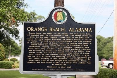
Orange Beach was named for the oranges that were grown here and exported until the hard-freezes of 1916. The orange groves are gone, but the name remained. Drawn here by the game they hunted, the early Indians discovered the seafood bounty of the Gulf of Mexico. The shell mounds and archeological digs give evidence of thousands of years of Indian visits. The Spanish land grants of Samuel Suarez and William Kee were the beginnings of area development. Logging and pine sap collection (turpentine/naval stores) were early industries. This sparsely populated wilderness was sustained by farming and fishing until the mid 1800s. Area battles during the Civil War brought a large influx of troops, many stayed or later returned causing the population to grow. Over the next 70 years, the community grew with commercial and sports fishing becoming its main industries. The completion of the Intra-Coastal Canal in 1932 brought more development. Travel to Pensacola was made easier in 1962 by a bridge from Alabama Point to Perdido Key.
(Continued on other side)
Reverse:
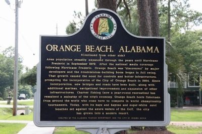
(Continued from other side)
Area population steadily expanded
this page online
Erected by Alabama Tourism Department and the City of Orange Beach.
Topics and series. This historical marker is listed in these topic lists: Entertainment • Settlements & Settlers. In addition, it is included in the Alabama Tourism Department series list. A significant historical month for this entry is September 1979.
Location. 30° 17.535′ N,
Photographed by TRCP Alliance, June 19, 2013
2. Orange Beach, Alabama Marker (Reverse)

Regionally, this marker is on Alabama’s Gulf Coast and in the Mobile Bay area. It is also in the American South, specifically in the Deep South, and on the Gulf Coast. Globally, it is in North America, a Gulf of Mexico state, the Western Hemisphere, the Western World, and the Anglosphere. Historically, it finds itself in what was once New Spain, the Viceroyalty of New France, the territory of the Mississippian Culture, one of the Confederate States of America, and the Antebellum South.
Other nearby markers. At least 8 other markers are within 4 miles of this marker, measured as the crow flies: Bay Circle (about 700 feet away, measured in a direct line); Orange Beach Municipal Complex (approx. 0.7 miles away); Hugh S. Branyon Backcountry Trail System (approx. 0.9 miles away); Perdido Pass (approx. 1.6 miles
Photographed by TRCP Alliance, June 19, 2013
3. Orange Beach, Alabama Marker (East)
Photographed by TRCP Alliance, June 19, 2013
4. Orange Beach, Alabama Marker (West)
Photographed by TRCP Alliance, June 19, 2013
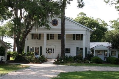
5. The Former Orange Beach Hotel
The Orange Beach Hotel was one of the first hotels to operate in the community dating back to the 1920's. Today, the building now serves as the Coastal Arts Center of Orange Beach. The Orange Beach, Alabama historical marker stands along the road in front of this building.
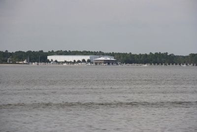
Photographed by TRCP Alliance, June 19, 2013
6. Barber Marina Situated Next To The Intra-Coastal Canal In The Orange Beach Area.
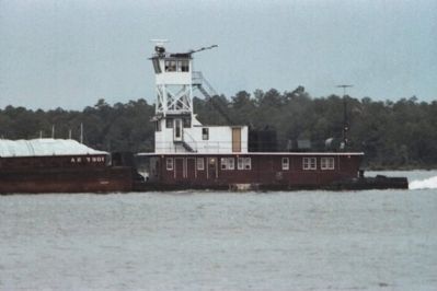
Photographed by TRCP Alliance, September 5, 1983
7. Towboat Pushing A Barge Through The Intra-Coastal Canal In The Orange Beach Area
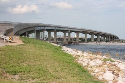
Photographed by TRCP Alliance, June 19, 2013
8. Perdido Pass Bridge, Linking Orange Beach To Perdido Key
Photographed by TRCP Alliance, June 19, 2013
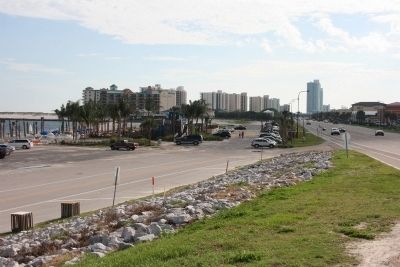
9. Looking West Along Perdido Beach Blvd In Orange Beach, Alabama.
Photographed by TRCP Alliance, June 20, 2013
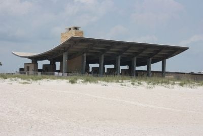
10. Beach Pavilion at Gulf State Park
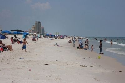
Gulf State Park is located between Gulf Shores and Orange Beach, Alabama. The beaches in this area is listed as the top cleanest beaches in the United States.
Photographed by TRCP Alliance, June 20, 2013
11. Looking East Along The Beach at Gulf State Park.
Credits. This page was last revised on June 16, 2016. It was originally submitted on June 27, 2013, by Timothy Carr of Birmingham, Alabama. This page has been viewed 3,875 times since then and 136 times this year. Last updated on March 23, 2015, by J. Makali Bruton of Washington, District of Columbia. Photos: 1, 2, 3, 4, 5, 6, 7, 8, 9, 10, 11. submitted on June 27, 2013, by Timothy Carr of Birmingham, Alabama. • Bill Pfingsten was the editor who published this page.
