Stockton in Baldwin County, Alabama — The American South (East South Central)
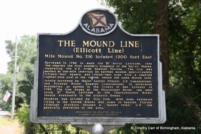
The Mound Line
(Ellicot Line)
| — | Mile Mound No. 216 located 1200 feet East | — |
Photographed by TRCP Alliance, June 22, 2013
1. The Mound Line Marker
Surveyed in 1799 to mark the 31° North Latitude, this line charted the first southern boundary of the United States, separating the U.S. from Spanish Florida. The line was marked at one-mile intervals by earthen mounds approximately fifteen-feet square and three-feet high with a charred lighter-pine post at the center, hence the name Mound Line.
Jointly surveyed by Major Andrew Ellicott, U.S. Commissioner, and Esteban Minor, Spanish Commissioner, to determine boundaries as agreed in the Treaty of San Lorenzo in 1795. The line began at the Mississippi River, ran east along 31° North Latitude to the Chattahoochie River, thence eventually to the Atlantic Ocean.
Stockton was divided by this line, with some residents living in the United States and some in Spanish Florida. Although Stockton became a “border town,” U.S. law generally prevailed in the area.
Sponsored by The Stockton Civic Club
Erected 1999 by Alabama Historical Association.
Topics and series. This historical marker is listed in this topic list: Settlements & Settlers. In addition, it is included in the Alabama Historical Association
this page online
Location. 30° 59.781′ N, 87° 51.415′ W. Marker is in Stockton, Alabama, in Baldwin County. It is on Alabama Route 59 north of Hodgson Road, on the right when traveling north. Touch for map. Marker is in this post office area: Stockton AL 36579, United States of America. Touch for directions.

Regionally, this marker is on the Gulf Coast and in the Mobile Bay area. It is also in the American South, specifically in the Deep South, and on the Gulf Coast. Globally, it is in North America, a Gulf of Mexico state, the Western Hemisphere, the Western World, and the Anglosphere. Historically, it finds itself in what was once New Spain, the Viceroyalty of New France, the territory of the Mississippian Culture, one of the Confederate States of America, and the Antebellum South.
Other nearby markers. At least 8 other markers are within 2 miles of this marker, measured as the crow flies: Bartram’s Trail (about 500 feet away, measured in a direct line); Stockton Presbyterian Church (approx. half a mile away); Historic Stockton / Old Schoolyard Park (approx. 1.1 miles away);
Photographed by TRCP Alliance, June 22, 2013
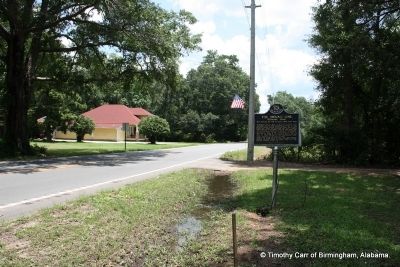
2. The Mound Line Marker (North)
Photographed by TRCP Alliance, June 22, 2013
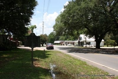
3. The Mound Line Marker (South) Downtown Stockton
Credits. This page was last revised on February 9, 2020. It was originally submitted on June 29, 2013, by Timothy Carr of Birmingham, Alabama. This page has been viewed 2,599 times since then and 261 times this year. Last updated on March 23, 2015, by J. Makali Bruton of Washington, District of Columbia. Photos: 1, 2, 3. submitted on June 29, 2013, by Timothy Carr of Birmingham, Alabama. • Bill Pfingsten was the editor who published this page.
