Sainte-Angèle-de-Monnoir in La Vallée-du-Richelieu, Québec — Central Canada (French-Canadian)
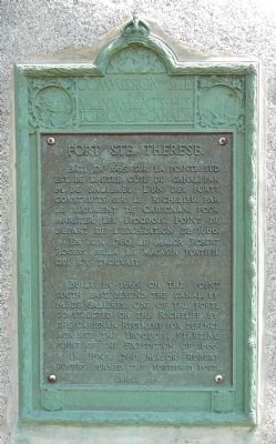
Fort Ste. Therese
Built in 1665, on the point south east beyond the canal, by M. de Salieres. One of the forts constructed on the Richelieu by the Carignan Regiment for defence against the Iroquois, starting point of the expedition of 1666. In June, 1760, Major Robert Rogers burned the fortified post.
French:
Bâti en 1665, sur la pointe sud-est, de l'autre côté du canal, par M. de Salières. L'un des forts construit sur le Richelieu, par le régiment de Carignan, pour arrêter les Iroquois. Point de départ de l'expédition de 1666. En juin 1760, le major Robert Rogers brule le magasin fortifié qui s'y trouvait.
Erected 1927 by Historic Sites and Monument Board of Canada/Commission de lieux et monuments historique du Canada.
Topics and series. This historical marker is listed in this topic list: Forts and Castles. In addition, it is included in the Canada, Historic Sites and Monuments Board series list. A significant historical month for this entry is June 1760.
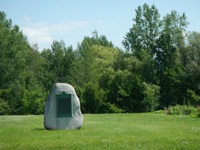
Location. 45° 23.832′ N, 73° 15.614′ W. Marker is in Sainte-Angèle-de-Monnoir, Québec, in La Vallée-du-Richelieu. Marker is on Chemin Sainte-Thérèse (Québec Route 233) close to Rue René Dumas, on the right when traveling south. Touch for map. Marker is at or near this postal address: 4293 Chemin Sainte-Thérèse, Sainte-Angèle-de-Monnoir QC J0L 1P0, Canada. Touch for directions.
Other nearby markers. At least 8 other markers are within 11 kilometers of this marker, measured as the crow flies. Fort Sainte-Thérèse (approx. 0.9 kilometers away); St. Stephen's Anglican Church (approx. 5.8 kilometers away); Chambly Canal (approx. 5.8 kilometers away); General John Thomas (approx. 5.9 kilometers away); Fort Chambly Cemetery (approx. 5.9 kilometers away); Fort Chambly (approx. 6 kilometers away); Albani (approx. 7 kilometers away); Former Grand Trunk Railway Station (approx. 10.5 kilometers away).
Credits. This page was last revised on June 16, 2016. It was originally submitted on March 28, 2015, by Barry Swackhamer of Brentwood, California. This page has been viewed 358 times since then and 10 times this year. Photos: 1, 2, 3. submitted on March 28, 2015, by Barry Swackhamer of Brentwood, California. • Andrew Ruppenstein was the editor who published this page.


