Saint-Paul-de-l'Île-aux-Noix in Le Haut-Richelieu, Québec — Central Canada (French-Canadian)
The Royal Navy
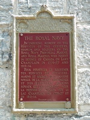
In enduring memory of the services of the officiers, seamen, and soldiers of the Royal Navy, Provincial Marine, and Royal Marines, who fought in defence of Canada on Lake Champlain in 1776-77 and 1812-1814.
French:
Pour perpétuer le souvenir des services des officiers, marins et soldats de la marine royale, de la marine provinciale et des fusiliers marins royaux qui ont combattu pour la défense du Canada sur le lac Champlain en 1776-77 en 1812-14.
Erected 1939 by Historic Sites and Monument Board of Canada/Commission de lieux et monuments historique du Canada.
Topics and series. This memorial is listed in these topic lists: War of 1812 • Waterways & Vessels. In addition, it is included in the Canada, Historic Sites and Monuments Board series list.
Location. 45° 7.224′ N, 73° 16.126′ W. Marker is in Saint-Paul-de-l'Île-aux-Noix, Québec, in Le Haut-Richelieu. Memorial can be reached from 61st Avenue close to Rue Principale (Québec Route 223). Touch for map. Marker is at or near this postal address: 1 61st Avenue, Saint-Paul-de-l'Île-aux-Noix QC J0J 1G0, Canada. Touch for directions.
Other nearby markers. At least 8 other markers are within 13 kilometers of this marker, measured as the crow flies. Fort Lennox (about 180 meters away, measured in a direct line); Chantier Naval de Île-aux-Noix (approx. 0.7 kilometers away); Caldwell Manor (approx. 6.7 kilometers away); Blockhaus de la Rivière-Lacolle (approx. 8.1 kilometers away); a different marker also named Blockhaus de la Rivière-Lacolle (approx. 8.1 kilometers away); Bataille du Moulin de Lacolle / Battle of the Lacolle Mill (approx. 8.3 kilometers away); Louis Cyr (approx. 10.2 kilometers away); La Bataille d’Odelltown / Battle of Odelltown (approx. 12.7 kilometers away). Touch for a list and map of all markers in Saint-Paul-de-l'Île-aux-Noix.
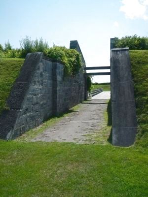
More about this marker. This marker is located at Fort Lennox in the passageway to the south battery. The fort is on l'Île-aux-Noix in the middle of the Richelieu River. Access to the island is by ferry from the above address.
Credits. This page was last revised on June 16, 2016. It was originally submitted on March 30, 2015, by Barry Swackhamer of Brentwood, California. This page has been viewed 330 times since then and 9 times this year. Photos: 1, 2. submitted on March 30, 2015, by Barry Swackhamer of Brentwood, California. • Andrew Ruppenstein was the editor who published this page.

