Knoxville in Knox County, Tennessee — The American South (East South Central)
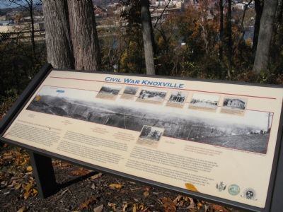
Civil War Knoxville
What Brought the Armies of the Blue and the Gray to Knoxville?
Knoxville was a pro-Confederate town of some 3700 persons when Tennessee seceded from the Union in June of 1861. It was the commercial and light manufacturing center of East Tennessee, a region of considerable agricultural importance that provided large quantities of wheat, corn, pork and other foodstuffs to areas beyond the great valley of the Tennessee River. Lying near the head of navigation of this great stream, Knoxville also sat astride the South’s most direct rail link between the Confederate capital of Richmond and the geographic region of the Confederacy that lay west of the Appalachian Mountains. To the north of the city lay vital mountain passes that controlled access to Tennessee from Kentucky, passes that would be of critical military importance during the Civil War. With the majority of the population of East Tennessee remaining loyal to the United States, Knoxville was a Confederate island in a sea of Union sympathy.
For almost two years the liberation of East Tennessee from Confederate control had been a dream of the Lincoln Administration. The American President held a great fondness for the loyal citizenry of the region, but it would require more than the President’s affection and concern for East Tennesseans before the Union Army would attempt an invasion of the great valley. Late summer 1863 found both the favorable conditions and the military imperative necessary to undertake this invasion.
In Kentucky the Union’s newest army, the Army of the Ohio, had been assembled under Major General Ambrose E. Burnside for the purpose of invading and occupying East Tennessee. In August of 1863 this army swept into the valley, with one of its two corps, the XXIII, marching through the Cumberland Mountains towards Knoxville. The veteran IX Corps slowly returned to Kentucky from service at Vicksburg under General U.S. Grant and rejoined the Army of the Ohio in Tennessee after a few weeks recuperation and refitting. This federal invasion had become necessary for a number of strategic reasons: 1) to cut the railroad link running between Virginia and the western Confederacy, 2) to deny the Rebels the vital food-producing region of East Tennessee, 3) to gain control of the strategic mountain passes through the Cumberlands, 4) to liberate the largely Unionist population of the region from Confederate domination, 5) to deny the South the use of this manufacturing town’s 7 mills, 2 foundries, and its arsenal and 6) to protect the vulnerable flank of William S. Rosencran’s Federal Army of the Cumberland as it conducted operations against the Confederate Army of Tennessee in northern Alabama and Georgia.
To counter these Union aims the Confederacy sent an army into East Tennessee to wrest control of the region away from Burnside. Under the command of Lt. General James Longstreet, Confederate forces made a concerted effort to recover the region and destroy Burnside’s army in November and December 1863. The main battles occurred in the Knoxville area, and determined the fate of the region through war’s end.
Erected by Knoxville Parks & Recreation and the Tennessee Wars Commissions.
Topics and series. This historical marker is listed in this topic list: War, US Civil. In addition, it is included in the Former U.S. Presidents: #18 Ulysses S. Grant series list. A significant historical month for this entry is June 1861.
Location. 35° 56.919′ N, 83° 54.977′ W. Marker is in Knoxville, Tennessee, in Knox County. Marker is on Fort Dickerson Road west of Chapman Highway SW, on the left when traveling north. Coordinates are estimated. Touch for map. Marker is in this post office area: Knoxville TN 37920, United States of America. Touch for directions.
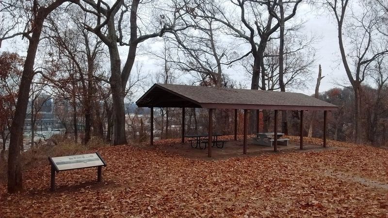
Other nearby markers. At least 8 other markers are within walking distance of this marker. Fort Dickerson 1863–64 (here, next to this marker); The 1863 Siege of Knoxville (here, next to this marker); Fort Dickerson (here, next to this marker); a different marker also named Fort Dickerson (within shouting distance of this marker); a different marker also named Fort Dickerson (within shouting distance of this marker); Forts Dickerson and Stanley (approx. 0.2 miles away); a different marker also named Fort Dickerson (approx. 0.3 miles away); Back Door to Knoxville (approx. 0.3 miles away). Touch for a list and map of all markers in Knoxville.
More about this marker. Marker contains a full width “Panoramic view of Knoxville, Tennessee taken in 1864 by George N. Barnard,” reproduced from a Library of Congress collection. Seven smaller photographs are above and below the panorama with the following captions, “Early 1864 photograph of the northwest bastion of Fort Saunders, site of the November 29, 1863 unsuccessful Confederate assault in which they suffered 813 casualties in 20 minutes. Union defenders suffered only 13.” “In the middle distance lies East Tennessee University (ETU is the modern-day location of ‘The Hill’ on the University of Tennessee campus).” “This 1859 roof-top view of Knoxville was taken by Thomas H.Smiley from the cupola of the Knox County Courthouse. View is north towards Sharp’s gap in the distance.” “Civil War Era Knox County Courthouse. It was located on Main Street, between Gay and Market—opposite the present day courthouse.” “An 1856 sketch by Auguste Bernard showing the yard, depot and workshops of the East Tennessee and Virginia Railroad.” “First Presbyterian Church, est. 1793. Site of burial of James White, Knoxville’s first settler, and William Blount, Gov. of the Southwest Territory.” “Federal soldiers cluster around the Tennessee Deaf and Dumb School in 1864. The building was used by both the Confederate and Federal Armies as a hospital.”
Regarding Civil War Knoxville. This is one of several markers interpreting Fort Dickerson and Civil War activity around Knoxville. See the Fort Dickerson Virtual Tour by Markers linked below.
Credits. This page was last revised on August 20, 2023. It was originally submitted on November 30, 2007, by Laura Troy of Burke, Virginia. This page has been viewed 2,525 times since then and 30 times this year. Last updated on April 6, 2015, by J. Makali Bruton of Accra, Ghana. Photos: 1. submitted on November 30, 2007, by Laura Troy of Burke, Virginia. 2. submitted on January 14, 2017, by Tom Bosse of Jefferson City, Tennessee. • Bill Pfingsten was the editor who published this page.

