Philadelphia in Loudon County, Tennessee — The American South (East South Central)
Battle of Philadelphia
Bivouac of Reconciliation
Photographed by Don Morfe, July 28, 2013
1. Battle of Philadelphia Marker
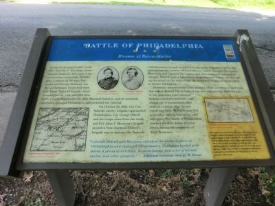
On October 20, 1863, two Confederate cavalry brigades approached Philadelphia. Col. George Dibrell and his troops came from the south, and Col. John J. Morrison's brigade moved in from the west. Dibrell's brigade was to distract the Federals while Morrison's brigade attacked from the north. Unaware of the Confederate movements, however, Wolford had sent wagons westward for supplies. Morrison's men captured the wagons, sent them south and continued his advance. Wolford knew a fight was on when he heard firing to the west during the attack on the wagon train. He dispatched almost half his troops to recover the wagons.
Morrison's assault on the Union position, which according to local tradition
this page online
“Colonels Dibrell and Morrison attacked the enemy in force at Philadelphia and captured 700 prisoners, 50 wagons loaded with stores, 6 pieces of artillery, 10 ambulances, and a lot of horses, mules, and other property.” — Adjutant General George W. Brent
(sidebar)
The mountain howitzer was a short-barreled, large caliber cannon designed on a small scale so that pack animals could transport it. It was ideal for fast-moving cavalry units. The guns could go anywhere the horses and mules could go and were light enough for soldiers to move forward by hand during a fight. Two of the six mountain howitzers captured at the Battle of Philadelphia are in private collections.
(captions)
Sweetwater to Knoxville, 1864 Courtesy Library of Congress
Col.
Photographed by Don Morfe, July 28, 2013
2. Battle of Philadelphia Marker
Col. George G. Dibrell Courtesy Sam Davis
Mountain howitzer on carriage Courtesy Library of Congress
Erected by Tennessee Civil War Trails.
Topics and series. This historical marker is listed in this topic list: War, US Civil. In addition, it is included in the Tennessee Civil War Trails series list. A significant historical date for this entry is October 20, 1863.
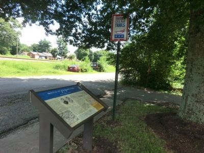
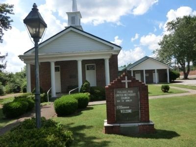
Location. 35° 40.769′ N, 84° 24.143′ W. Marker is in Philadelphia, Tennessee, in Loudon County. It is at the intersection of Church Street and Jaynes Street, on the right when traveling south on Church Street. The marker is located on the grounds of the Philadelphia United Methodist Church. Touch for map. Marker is at or near this postal address: 408 Church Street, Philadelphia TN 37846, United States of America. Touch for directions.

Regionally, this marker is in East Tennessee and in Greater Knoxville. It is also in the American South, specifically in the Upper South, in Appalachia, and specifically in Southern Appalachia. Globally, it is in North America, the Western Hemisphere, the Western World, and the Anglosphere.
Photographed by Don Morfe, July 28, 2013
3. Philadelphia United Methodist Church
Other nearby markers. At least 8 other markers are within 6 miles of this marker, measured as the crow flies: Affair at Philadelphia (approx. 0.2 miles away); Dunbar Rosenwald School (approx. 5.4 miles away); Tennessee Meiji Gakuin High School 1989-2007 (approx. 5.6 miles away); Loudon County Courthouse (approx. 5.7 miles away); Sgt. Mitchell W. Stout (approx. 5.7 miles away); T M I Academy (approx. 5.7 miles away); Loudon County Confederate Memorial (approx. 5.7 miles away); Longstreet's Crossing (approx. 5.7 miles away).
Credits. This page was last revised on November 11, 2024. It was originally submitted on October 16, 2013, by Don Morfe of Baltimore, Maryland. This page has been viewed 3,179 times since then and 217 times this year. Last updated on April 7, 2015, by J. Makali Bruton of Washington, District of Columbia. Photos: 1, 2, 3. submitted on October 16, 2013, by Don Morfe of Baltimore, Maryland. • Bill Pfingsten was the editor who published this page.
