Lake Anna State Park near Spotsylvania Courthouse in Spotsylvania County, Virginia — The American South (Mid-Atlantic)
Spotsylvania's War Effort
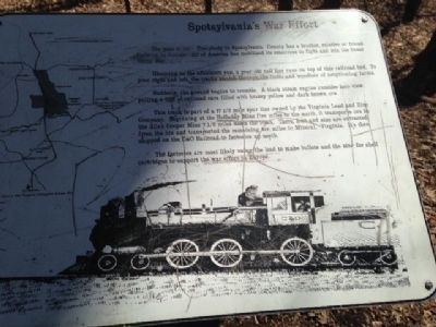
The year is 1917. Everybody in Spotsylania County has a brother,relative or friend fighting in Europe. All of America has mobilized its resources to fight and win the Great World War.
Gleaming in the afternoon sun, a year-old rail line runs on top of this railroad bed. To your right and left, the tracks stretch through the fields and woodlots of neighboring farms.
Suddenly, the ground begins to tremble. A black steam engine rumbles into view, pulling a line of railroad cars filled with brassy yellow and dark brown ore.
This track is part of the 17½ mile spur line owned by the Virginia Lead and Zinc Company. Beginning at the Holladay Mine five miles to the north, it transports ore to the Allah Cooper Mine 7½ miles down the track. There, lead and zinc are extracted from the ore and transported the remaining ten miles to Mineral, Virginia. It's then shipped on the C&O Railroad to factoring up north.
The factories are most likely using the lead to make bullets and the zinc for shell cartridges to support the war effort in Europe.
Topics. This historical marker is listed in these topic lists: Industry & Commerce • Railroads & Streetcars • War, World I. A significant historical year for this entry is 1917.
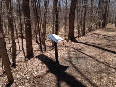
Location. 38° 6.488′ N, 77° 49.815′ W. Marker is near Spotsylvania Courthouse, Virginia, in Spotsylvania County. It is in Lake Anna State Park. Marker can be reached from State Park Lane, 2.7 miles south of Lawyers Road (County Route 601). Marker located on the Railroad Ford hiking trail within Lake Anna State Park. Touch for map. Marker is at or near this postal address: 6800 Lawyers Road, Spotsylvania VA 22551, United States of America. Touch for directions.
Other nearby markers. At least 8 other markers are within 11 miles of this marker, measured as the crow flies. Fredericksville Furnace (approx. 2.7 miles away); Spotsylvania’s First African American Church (approx. 6 miles away); Social and Economic Richness in the Livingston District (approx. 6.4 miles away); Civilian Conservation Corps Company 2359 (approx. 8.3 miles away); Jerdone Castle (approx. 8.4 miles away); Clayton's Store (approx. 9.2 miles away); First Contact (approx. 10½ miles away); Richardson and Morton Schools (approx. 10.6 miles away). Touch for a list and map of all markers in Spotsylvania Courthouse.
Credits. This page was last revised on February 20, 2023. It was originally submitted on April 8, 2015, by Charles T. Harrell of Woodford, Virginia. This page has been viewed 363 times since then and 11 times this year. Photos: 1, 2. submitted on April 8, 2015, by Charles T. Harrell of Woodford, Virginia. • Bernard Fisher was the editor who published this page.

