Fort Sill in Comanche County, Oklahoma — The American South (West South Central)
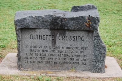
Quinette Crossing
In memory of William H. Quinette, Post Trader, 1878-1915. Old crossing on road to Fort Cobb. General Sheridan's HQ mess tent was pitched here 10 Jan - 23 Feb 1869 when he founded Fort Sill.
Topics. This historical marker is listed in these topic lists: Forts and Castles • Settlements & Settlers. A significant historical date for this entry is February 23, 1869.
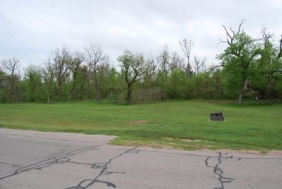
Location. 34° 40.694′ N, 98° 23.603′ W. Marker is in Fort Sill, Oklahoma, in Comanche County. Marker is on Quinette Road, 0.3 miles north of Upton Road, on the right when traveling east. Located on the grounds of Fort Sill. Fort Sill is an active U.S. military installation. Appropriate identification is required for access. Touch for map. Marker is in this post office area: Fort Sill OK 73503, United States of America. Touch for directions.
Other nearby markers. At least 8 other markers are within walking distance of this marker. Old Redoubt (approx. half a mile away); Sherman House (approx. 0.6 miles away); Cavalry Company Quarters (approx. 0.6 miles away); Old Post (approx. 0.7 miles away); Sill (approx. 0.7 miles away); Post Chapel (approx. 0.7 miles away); Infantry Barracks (approx. 0.7 miles away); Post Guardhouse (approx. 0.7 miles away). Touch for a list and map of all markers in Fort Sill.
Also see . . . Fort Sill, Oklahoma. Website homepage (Submitted on April 13, 2015, by Mike Wintermantel of Pittsburgh, Pennsylvania.)
Credits. This page was last revised on November 25, 2021. It was originally submitted on April 13, 2015, by Mike Wintermantel of Pittsburgh, Pennsylvania. This page has been viewed 615 times since then and 25 times this year. Photos: 1, 2. submitted on April 13, 2015, by Mike Wintermantel of Pittsburgh, Pennsylvania.

