Hamburg in Erie County, New York — The American Northeast (Mid-Atlantic)
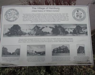
The Village of Hamburg
A Brief History of "White's Corners"
This panoramic photograph shows the four corners of Main and Buffalo Streets, decorated to celebrate "old Home Days", the 10th anniversary of the town of Hamburg. This photograph was taken in 1912 by Frank J. Fisher using a Cirkut camera that rotated 360 degrees on its tripod, capturing the village activity.
The southwest corner was dominated by Federspell Grocery Store. This building was later used as Eckhardt's Hotel, and then Kronenberg's Store before it burned in 1972.
The Bunting Block stood on the northwest corner. This landmark was built by Thomas L. Bunting and housed "six stores in one." Horton's Pharmacy was located on this corner for many years. The Bunting Building Block was destroyed by fire on May 23, 1969.
Kopp's Hotel and Opera House was on the northeast corner. This is where George Kopp ran the largest and most lively social hall on the village. All the big events were held here; music recitals, Hamburg Academy graduations and the annual Hamburg Free Library Ball.
The B.M. Fish Dry Goods Srore was on the southeast corner. Burton M. Fish operated the store. The Hamburg Free Library was located on the second floor until 1915. The Fish building burned in 1917 and the Hotel Hamburg, also located on this site, burned in 1967.
Erected 2008 by Village of Hamburg Historic Preservation Commission.
Topics. This historical marker is listed in these topic lists: Industry & Commerce • Settlements & Settlers. A significant historical year for this entry is 1820.
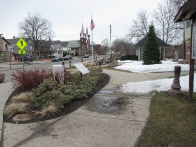
Location. 42° 42.936′ N, 78° 49.75′ W. Marker is in Hamburg, New York, in Erie County. Marker is at the intersection of South Buffalo Street and East Main Street (New York State Route 391), on the right when traveling north on South Buffalo Street. Marker is in Centennial Park on the traffic circle, which is the terminus of NY 391 at US 62. Touch for map. Marker is in this post office area: Hamburg NY 14075, United States of America. Touch for directions.
Other nearby markers. At least 8 other markers are within walking distance of this marker. Main Street Village of Hamburg (within shouting distance of this marker); Anna Mae Bacon Bird Sanctuary (within shouting distance of this marker); Village of Hamburg Historic Walking Tour (about 400 feet away, measured in a direct line); Smith Alley (about 400 feet away); Kronenberg Alley (about 500 feet away); Isaac Long Alley (about 600 feet away); a different marker also named The Village of Hamburg (approx. 0.2 miles away); Donald "Duke" Spittler (approx. 0.7 miles away). Touch for a list and map of all markers in Hamburg.
More about this marker. I believe NY 391 is old US 219 prior to its construction as a thruway off of I-90.
Also see . . . Cirkut - Wikipedia. (Submitted on April 15, 2015, by Anton Schwarzmueller of Wilson, New York.)

Photographed By Anton Schwarzmueller, March 31, 2015
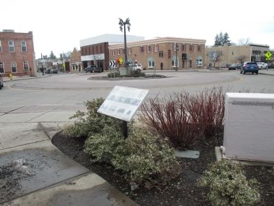
3. The Village of Hamburg Marker and Traffic Circle
The building at center is on the northwest corner. Buffalo Street is right of the center building; Main Street is left. The building at the left is 12 Main Street and is the backdrop for the Main Street Village of Hamburg marker.
Credits. This page was last revised on June 16, 2016. It was originally submitted on April 15, 2015, by Anton Schwarzmueller of Wilson, New York. This page has been viewed 633 times since then and 55 times this year. Photos: 1, 2, 3. submitted on April 15, 2015, by Anton Schwarzmueller of Wilson, New York.

