Sevierville in Sevier County, Tennessee — The American South (East South Central)
Knoxville, Sevierville & Eastern Railway
(KS & E)
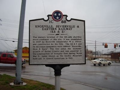
Photographed by Stanley and Terrie Howard, March 14, 2009
1. Knoxville, Sevierville & Eastern Railway Marker
Erected by Tennessee Historical commission. (Marker Number 1C 88.)
Topics and series. This historical marker is listed in this topic list: Railroads & Streetcars. In addition, it is included in the Tennessee Historical Commission series list. A significant historical year for this entry is 1907.
Location. 35° 52.168′ N, 83° 34.065′ W. Marker is in Sevierville, Tennessee, in Sevier County. It is on W Main (U.S. 441). Touch for map. Marker is in this post office area: Sevierville TN 37862, United States of America. Touch for directions.

Regionally, this marker is in East Tennessee and in the Great Smoky Mountains. It is also in the American South, specifically in
this page online
Other nearby markers. At least 8 other markers are within walking distance of this marker: Forks of Little Pigeon Church (a few steps from this marker); The Mayors of the City of Sevierville (about 700 feet away, measured in a direct line); James Crawford Murphy (about 700 feet away); Sevierville (about 800 feet away); Hon. Lieut. Spencer Clack (about 800 feet away); William M. Whaley (about 800 feet away); Isaac Dockery (approx. 0.2 miles away); Public Square History (approx. 0.2 miles away). Touch for a list and map of all markers in Sevierville.
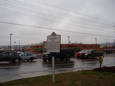
Photographed by Stanley and Terrie Howard, March 14, 2009
2. Knoxville, Sevierville & Eastern Railway Marker
Credits. This page was last revised on June 16, 2016. It was originally submitted on March 16, 2009, by Stanley and Terrie Howard of Greer, South Carolina. This page has been viewed 1,598 times since then and 47 times this year. Last updated on April 24, 2015, by J. Makali Bruton of Washington, District of Columbia. Photos: 1, 2. submitted on March 16, 2009, by Stanley and Terrie Howard of Greer, South Carolina. • Andrew Ruppenstein was the editor who published this page.
