Vantage in Kittitas County, Washington — The American West (Northwest)
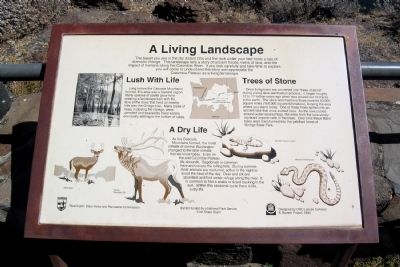
A Living Landscape
Lush With Life
Long before the Cascade Mountains formed, this area was a lowland region. Many species of plants grew here creating a landscape lush with life. One of the trees that lived on nearby hills was the Ginkgo tree. Many types of trees, including the Ginkgo, were uprooted and soaked by flood waters, eventually settling to the bottom of lakes.
Trees of Stone
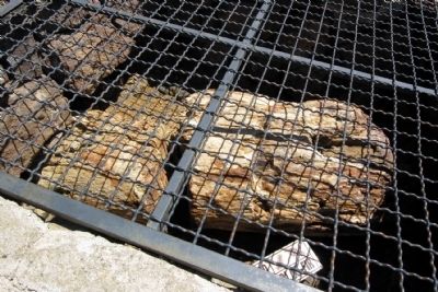
Once living trees are converted into “trees of stone” during a long slow petrification process. It began roughly 12 to 17 million years ago when lava poured out of cracks in the earth. The silica enriched lava flows covered 63,000 square miles (164,000 square kilometers), burying the area where you stand today. One of these flows spilled into an ancient lake that once existed here. As the lava cooled around water soaked logs, the silica from the lava slowly replaced organic cells in the trees. Over time these fallen trees were transformed into the petrified forest of Ginkgo State Park.
A Dry Life
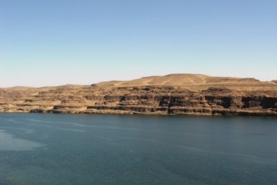
As the Cascade Mountains formed, the moist climate of central Washington changed to the drier climate that we know today. Even on the arid Columbia Plateau life abounds. Sagebrush is common here and covers the rolling hills. During summer most animals are nocturnal, active in the night to avoid the heat of the day. Deer and elk are abundant and find winter refuge along the river. It is common to find a snake or lizard basking in the sun. Within this seasonal cycle there is life, a dry life.
Erected by Washington State Parks.
Topics. This historical marker is listed in this topic list: Notable Places.
Location. 46° 57.284′ N, 119° 59.273′ W. Marker is in Vantage, Washington, in Kittitas County. Marker can be reached from Ginkgo Avenue, half a mile north of Vantage Highway. Marker is located at the interpretive center for the Ginkgo Petrified Forest State Park; a entrance fee may be required. Touch for map. Marker is in this post office area: Vantage WA 98950, United States of America. Touch for directions.
Other nearby markers. At least 8 other markers are within 2 miles of this marker, measured as the crow flies. Explore Massive Floodscapes! (here, next to this marker); In the Path of Cataclysmic Floods (here, next to this marker); Carving Out Basalt Layers (a few steps from this marker);
Here and Gone (a few steps from this marker); Buried by Enormous Lava Floods (within shouting distance of this marker); Welcome to Ginkgo Petrified Forest State Park (within shouting distance of this marker); The Wanapums (approx. 1.2 miles away); Ginkgo Petrified Forest State Park (approx. 1.2 miles away). Touch for a list and map of all markers in Vantage.
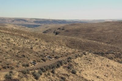
Regarding A Living Landscape. The interpretive trails for the Ginkgo Petrified Forest are located two miles west of the interpretive center on Vantage Highway.
Also see . . . Ginkgo Petrified Forest State Park - Wikipedia entry. (Submitted on May 2, 2015, by Duane Hall of Abilene, Texas.)
Credits. This page was last revised on June 16, 2016. It was originally submitted on May 2, 2015, by Duane Hall of Abilene, Texas. This page has been viewed 303 times since then and 8 times this year. Photos: 1, 2, 3, 4. submitted on May 2, 2015, by Duane Hall of Abilene, Texas.
Editor’s want-list for this marker. Photo of wide-view of marker and surrounding area • Can you help?


