Downtown in Tucson in Pima County, Arizona — The American Mountains (Southwest)
El Paso & Southwestern Depot and Park
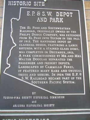
Photographed by Bill Kirchner, January 1, 2010
1. E.P.&S.W. Depot and Park Marker
[ Spanish Translation: ]
Erected by Tucson-Pima
this page online
Topics. This historical marker is listed in these topic lists: Architecture • Railroads & Streetcars. A significant historical month for this entry is December 1913.
Location. 32° 13.214′ N, 110° 58.668′ W. Marker is in Tucson, Arizona, in Pima County. It is in Downtown. It is on West Congress Street, on the right when traveling east. Touch for map. Marker is at or near this postal address: 419 W Congress St, Tucson AZ 85701, United States of America. Touch for directions.

Regionally, this marker is in the Sky Islands, in the Sonoran Desert, and in the Phoenix Metropolitan Area. It is also in the American Borderlands and in the Southwest. Globally, it is in North America, the Western Hemisphere, the Western World, and the Anglosphere. Historically, it finds itself in what was once New Spain and also the Gadsden Purchase.
Other nearby markers. At least 8 other markers are within walking distance of this marker: Granada Avenue (about 700 feet away, measured in a direct line); Congress Street (about 800 feet away); Pearl Street / Ott Street (about 800 feet away); Main Avenue
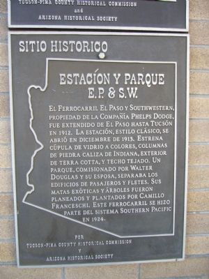
Photographed by Bill Kirchner, January 1, 2010
2. E.P.&S.W. Depot and Park Marker
Spanish translation of marker text.
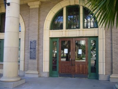
Photographed by Bill Kirchner, January 1, 2010
3. E.P.&S.W. Depot Entrance
Marker is to left of door.
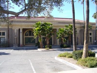
Photographed by Bill Kirchner, January 1, 2010
4. E.P.&S.W. Depot
Credits. This page was last revised on June 28, 2025. It was originally submitted on January 6, 2010, by Bill Kirchner of Tucson, Arizona. This page has been viewed 2,128 times since then and 81 times this year. Last updated on May 6, 2015, by J. Makali Bruton of Washington, District of Columbia. Photos: 1, 2, 3, 4. submitted on January 6, 2010, by Bill Kirchner of Tucson, Arizona. • Bill Pfingsten was the editor who published this page.
